
Sertan Usanmaz
Erciyes Dagi (Mount Argaeus) Summit Hike (via Classic Route)
What inspired me to climb Mount Erciyes
Mount Erciyes, also known as Argaeus is a massive 12,854-foot (3,917m) stratovolcano in Turkey, which makes it the highest mountain and most voluminous volcano in the Central Anatolian region. This impressive statistic also makes it Turkey’s 6th tallest mountain! The volcano is surrounded by many monogenetic vents and lava domes, and one maar. The bulk of the volcano was formed by lava flows and at some time in the past, part of the summit collapsed towards the east after a massive eruption.
This climb was somewhat spontaneous since I had only found out about this mountain only recently during a three weeklong vacation to Turkey and decided to climb it as a warmup in order to prepare for a more strenuous mountain, I was planning on climbing later in the week (Mount Ararat). I was also inspired to climb Mount Erciyes because there is a rumor that on a super clear day, you could see both the Black and Mediterranean seas from the summit so of course I had to see if this statement was true.
Mount Erciyes Summit Hike © Sertan Usanmaz
Preparing to climb Mount Erciyes via the Standard Summit Route + Logistics
Mount Erciyes’ standard summit route also known as the Classics Route is a very difficult and taxing ascent on the human body which involves an elevation gain of over 5,000 feet from the base of the mountain to the summit. I was planning on attempting this climb in one-day and I knew that I would need to be in excellent shape to tackle such a difficult endeavor. For me though this wasn’t as much of an issue because I tend to stay in shape year-round but one of the ways I’d recommend one improves their physical abilities is by going to the gym and hopping on the Stairmaster. The Stairmaster is an excellent workout to help improve one’s physical abilities and strength as it relates to climbing a mountain. I personally spend 45 minutes a day and 3 times a week on the Stairmaster.
Mount Erciyes is in the Turkish province of Kayseri, which happens to be smack dab in the middle of the country. There is actually a very popular ski resort at the base of the mountain known as Erciyes Ski Resort where I ended up meeting some good friends at the end of my trek (more on that later).
To get to Kayseri, I took a flight from Istanbul to with Turkish Airlines and to the Kayseri Airport. Once I arrived at the airport, I arranged a private taxi driver to take me to the Erciyes Ski resort (which cost about 500 Turkish Liras round trip) which is where my climb begun. So the Classic Route to the summit begins at the base at the Erciyes Ski Resort and climbs a ridge up the summit. if you would like an overview of the route, I can share my GPX file so feel free to reach out!
Is Mount Erciyes a Dangerous Ascent?
I did this hike via a solo ascent, but this is not something I recommend since the trail gets somewhat tricky after the Horguc Kaya (a prominent landmark right under the final ascent to the summit). I decided to hike this one solo because I knew I had to be quick and couldn’t have anyone slow me down. Also, I had mustered enough confidence having done some reach on the trail leading up to my trek. I felt ready for the challenge. I was also on a time crunch because I had to catch a flight to the Turkish province of Igdir the next day to prepare for my climb up Mount Ararat, which means I only had a 24-hour window to climb this mountain.
There is also another more technical route you can take up to the summit known as the Devil’s Route. As you can imagine, this route gets its name due to its technical ascent up a very steep gully with lots of loose rock. A climber had actually died earlier in the week descending the Devil’s Route due to falling rocks, which made me extra cautious on my ascent. One of the reasons that make this route so dangerous is that during the summer, the snow melts and exposes all the loose rock and boulders on this route which can come tumbling down.
Anyways, my intention was not to scare you but it’s always good to be aware of the risks involved when climbing a mountain so we can make informed decisions about our safety while on the mountain. You can also hire a local guide to climb Erciyes but considering my experience, I did not think that was going to be necessary. Also, I wanted to note that the trail had no permitting requirements so you could just show up and climb it. Overall, the trail was well defined and easy to follow up until the Horguc Kaya, then it got tricky because the trail disappeared. I had to use route finding skills and reference contour lines to understand how to get around the massive rock. This is also where the Devil’s Route links back up with the Classic Route before the final push to the summit. One of the biggest concerns here is that the Horguc Kaya is a massive overhanging rock which creates a significant risk for rock falls, so you need to pass through this section relatively quickly with good foot placements to clear the area of danger. This was the single most dangerous portion of the trek.
Overview of Mount Erciyes Standard Summit Route
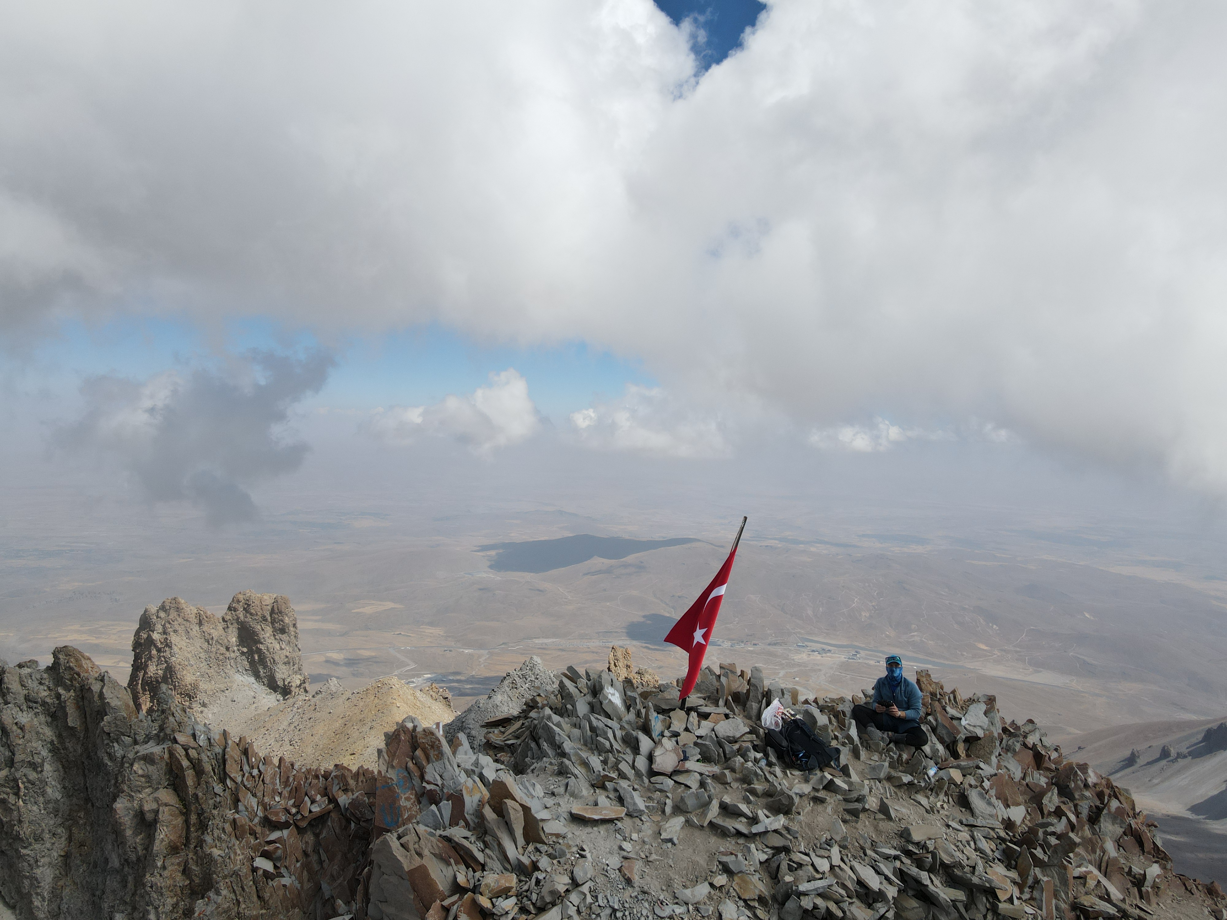
Access to the summit area involves a strenuous 13-14 mile hike with 5,000~ of elevation gain, starting from the Kayseri Ski Resort at the base of the mountain, referred to as the Classic Route. On a clear day, climbers are rewarded with awesome views of both the Black and Mediterranean Seas, which could be seen from the summit! The scenery along the way was remarkable. At the base it starts off at the Kayseri Ski Resort which is primarily loose rock, gravel and dirt in the winter season, practically all the mountain is covered in snow, which could make for a cleaner ascent via the use of crampons for traction. As I slowly made my way up to 10,000 feet, the scenery became more breathtaking since the Classic Route follows a ridgeline for most of the way up to the summit after you pass 10,000 feet. By the time I reached 11,500 feet, the trail became a lot rockier with large boulders after you pass by the Horguc Kaya (rock) at this point the trail disappears and you have to quicky navigate through the steep boulder field on the final ascent to the summit. you need to be careful though since this is where most of the climbing accidents tend to happen. Also, this is where the Classic Route links up with the Devil’s Route for the final summit push. After you pass through the boulder fields and crest over the ridgeline, the trail becomes more visible, and you only have a few hundred more feet to the summit! But you need to be careful on this last section because the ridgeline is narrow, and a misstep could prove to be fatal so watch your step! The views from the summit were outstanding and the drop-offs were exhilarating! Clouds were passing through the summit during my time up there, but it wasn’t windy, so I was lucky enough to capture some mazing drone footage during my 30-minute stay at the summit before I began by descent.
Duration of Mount Erciyes Standard Summit Route
I climbed Mt Erciyes as a day hike on Sunday, 9/18 in order to acclimates for Agrı Dağ later in the week! I gained a total of 5,300~ feet in elevation from the base of the mountain to the summit, the Classic Route is not very technical in nature, but it is a long haul to say the least. Nevertheless, it was an awesome experience! This ascent was done in one day and I gained a total of around 5,000~ feet in elevation from the base of the mountain to the summit, the Classic Route is not very technical but at 13~ miles round trip, it was definitely a long haul to the summit but nevertheless, it was an awesome experience! This hike could also be completed in two days for a more enjoyable experience by camping halfway up at 10,000 feet. This would also help acclimatize to the higher altitudes on the mountain since the summit is still a couple thousand feet higher. The hardest part of the trek was navigating around the Horguc Kaya since there was an increased danger of rock falls on that segment of the climb, this meant I had to move quickly to circumvent any potential injuries on the mountain.
Most Challenging Aspect about this Climb
I think the most difficult aspect of this climb is the fact that I completed it in less than 12 hours. Very good physical conditioning is required to do this and great mental fortitude. I think another aspect of this climb which makes it quite difficult is having the will power to continue pushing forward through the Horguc Kaya since this section involves path finding skills and agility to move through the dangerous boulder field.
Number One Highlight of this Experience
The number one highlight from this climb were the epic and insane views from the summit. you can see 360 degrees in every direction. Mount Erciyes is centered in the heart of Turkey. On a very clear day, both the Mediterranean and Black Seas are visible from the summit. Unfortunately, during my 30 minutes at the summit, clouds were rolling in and out so I didn’t get to see this spectacle for myself, but I was able to capture some epic drone footage! It was remarkable to see deep into the lands of this beautiful country from such a high vantage point. I personally really enjoyed the views from the top and the challenge of it all.
Where to Stay near Mount Erciyes
On my arrival into the Turkish province of Kayseri, I stayed at the Erciyes Ski Resort for one night. The hospitality was great (Turkish people tend to show a ton of hospitality to foreigners), and the rates were very affordable ($50~ per night). This was also the location which is operated as a ski resort during the winter season. The resort managers were very resourceful and connected me with all the local services so I could organize my taxicab ride back to the airport and they fed me delicious Turkish food as well! Another option is to climb Mount Erciyes with a guide which the resort managers can arrange for you if you would prefer to pay for a guide up the mountain for added safety.
Need to Know Before you Go
Do not go solo, you want to make sure you stay safe. Although I did this climb so, I would not recommend it unless you have extensive route finding experience.
Different equipment will be required depending on the time of season you decide to climb Mount Erciyes. Technical equipment like an ice axe and crampons will be required during the winter climbing season.
Acclimatization is a very important step when attempting this climb so make sure you acclimatize properly in order to avoid altitude sickness as you ascend the mountain, which is why I recommend the climb be done over two days.
You should know how to use a map and possess route-finding experience if snow is present.
Carry a satellite communication device in case of an emergency (like a Garmin in Reach).
I recommend a minimum 42 litter backpack for this trek to carry all your gear and personal belongings – especially if climbing over two days.
If you have further questions about this climb, you can reach out to me via the contact me button located at the top of my website.
Also, follow my Instagram account @sertanusanmaz – and shoot me a message if you are looking to connect! You can watch my Instagram story highlight of this trek by clicking here.
You can also watch this hike on my YouTube Channel (please subscribe!) by clicking here.
Happy Trails!

Sertan Usanmaz
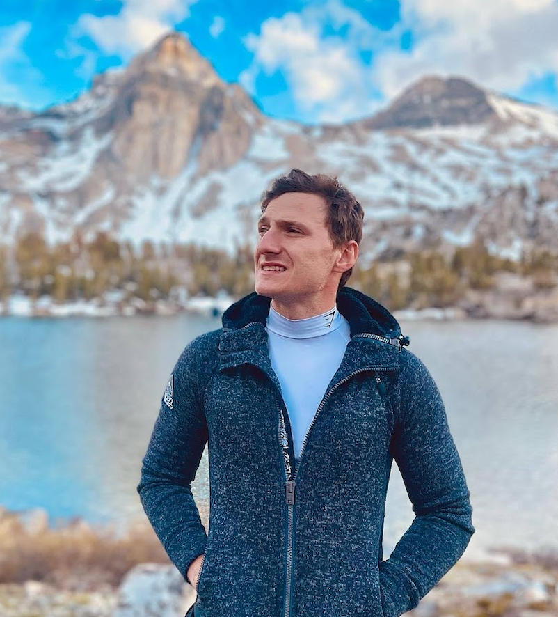
Sertan is an avid outdoor enthusiast who loves summiting mountains, traveling, being in nature, and helping others find their passion for hiking!
