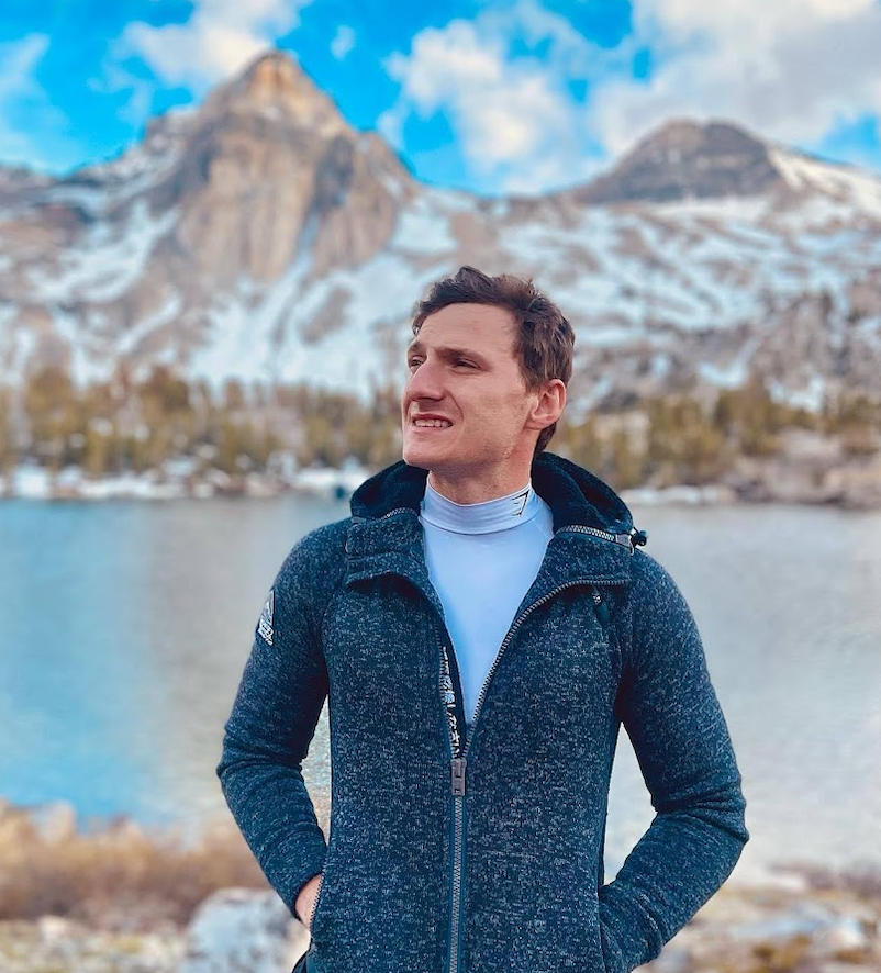
Sertan Usanmaz
Mount Whitney Mountaineer’s Route
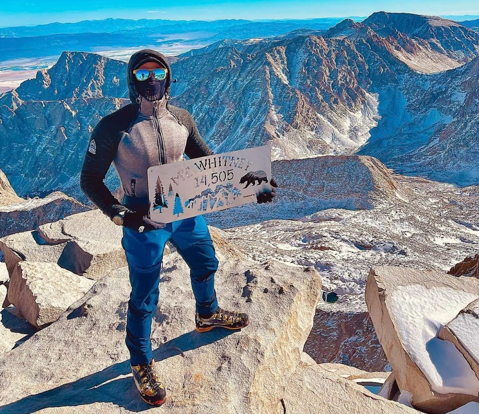
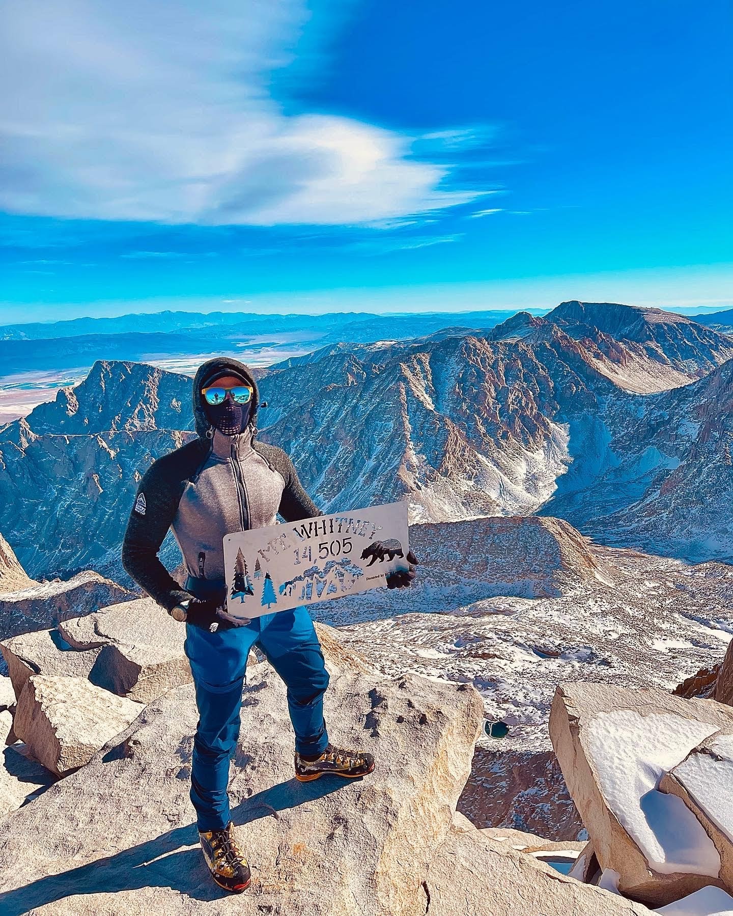
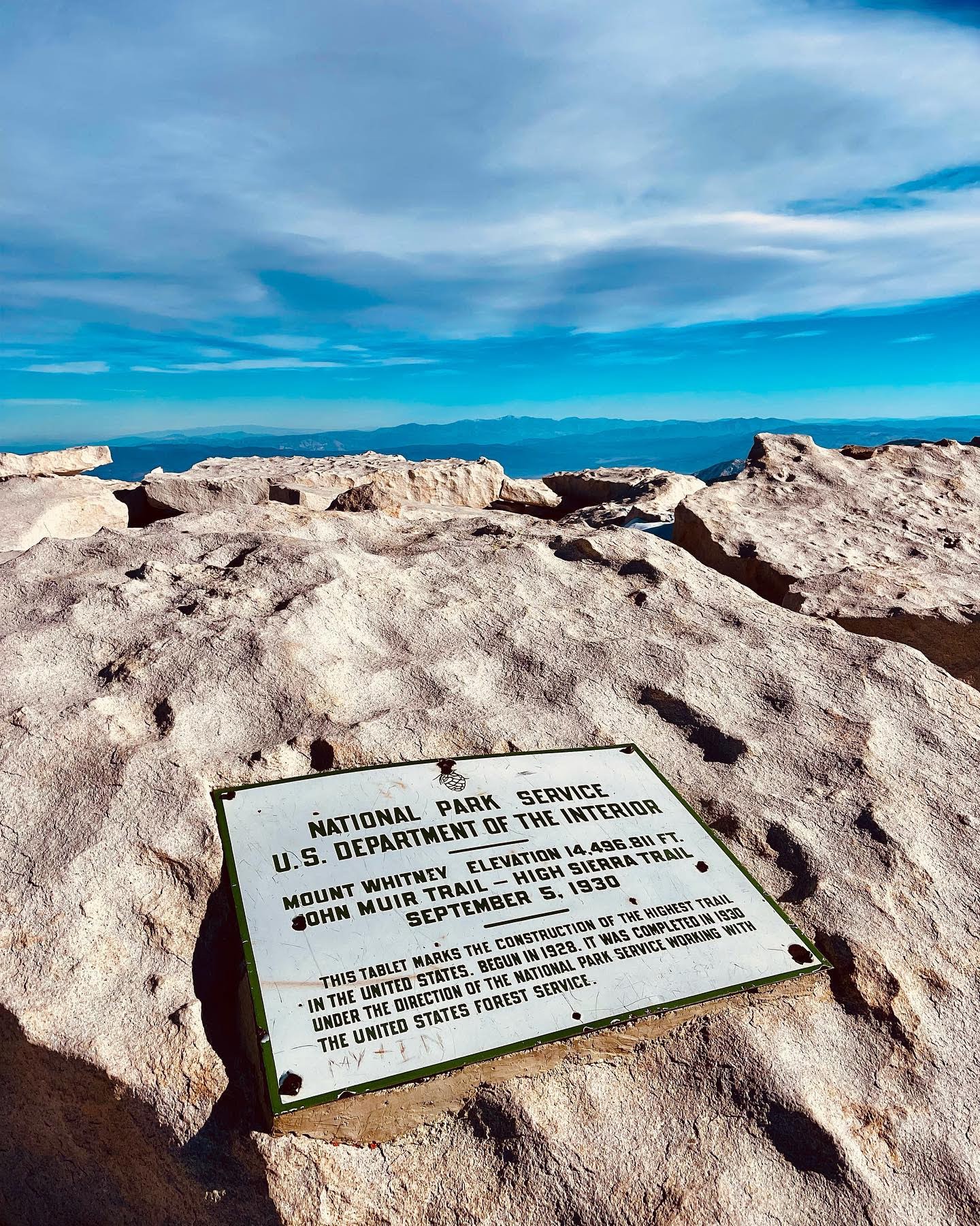
At 14,505 feet Mount Whitney is the tallest peak in the lower 48 contiguous United States. I am someone who lives for the challenge of climbing the tallest peaks around the world. That being said, Mount Whitney Mountaineer’s Route was an easy target, especially since I live in California.
Also, I’ve climbed Mount Whitney three other times but all three times were via the main Mount Whitney trail which is a longer approach but less technical. I’ve heard of the Mountaineer’s Route a few different times and knew it was a shorter yet much more difficult/technical approach.
It was on my list for the last year or so but my friends and I were waiting for the right weather, which we found on December 10-11. We also watched the Netflix documentary “14 Peaks” and were inspired by it to attempt to climb a winter summit of our own (the tallest we could find in California)!
Preparing for Mount Whitney Mountaineer’s RouteWhen training for a winter summit of this magnitude, it requires both mental and physical preparation. I had climbed a few other peaks in the winter but none of them were anywhere close to the height of Whitney. So I knew that I would have to take my mental prep to the next level.
I am someone that believes that having the right mentality is half the battle when it comes to tackling a mountain of this magnitude, especially in the winter. I knew that the conditions were going to be rough.
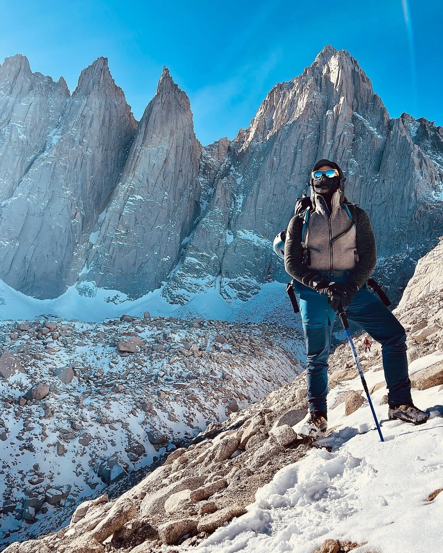
You must have mountaineering experience to attempt this route. You need specialized mountaineering equipment like crampons and an ice axe and knowledge surrounding how to use them. We took these special tools with us in order to make the final push to the summit. In terms of physical training, I didn’t really change much. I’m someone who goes to the gym regularly and do cardio, so I maintain my physical conditioning year-round.
I did do some similar hikes but not quite as tall in order to prepare and acclimatize to the alpine environment on Mount Whitney. The air gets thinner as you climb higher so breathing becomes difficult. That is why acclimatizing is important and will help you avoid mountain sickness.
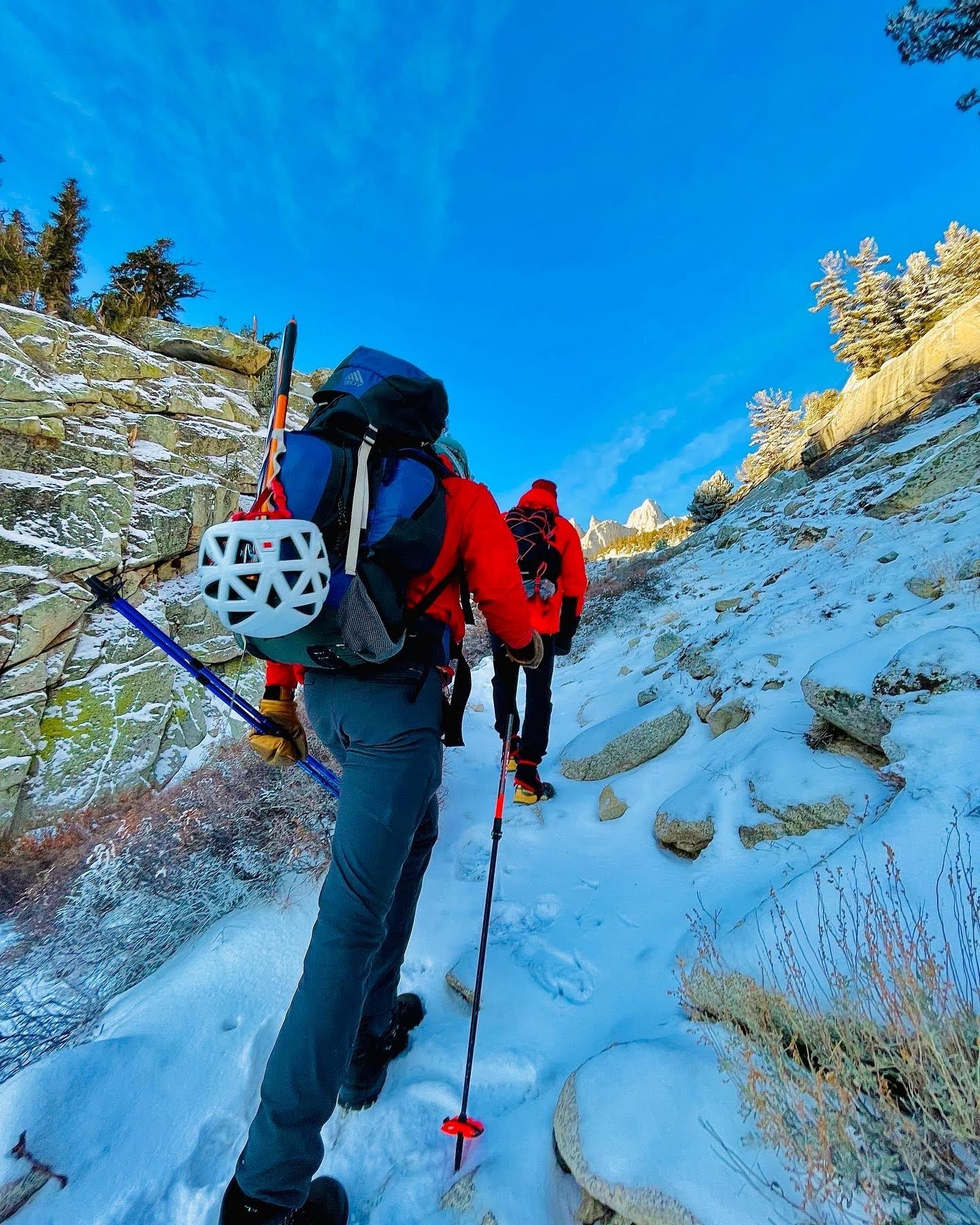
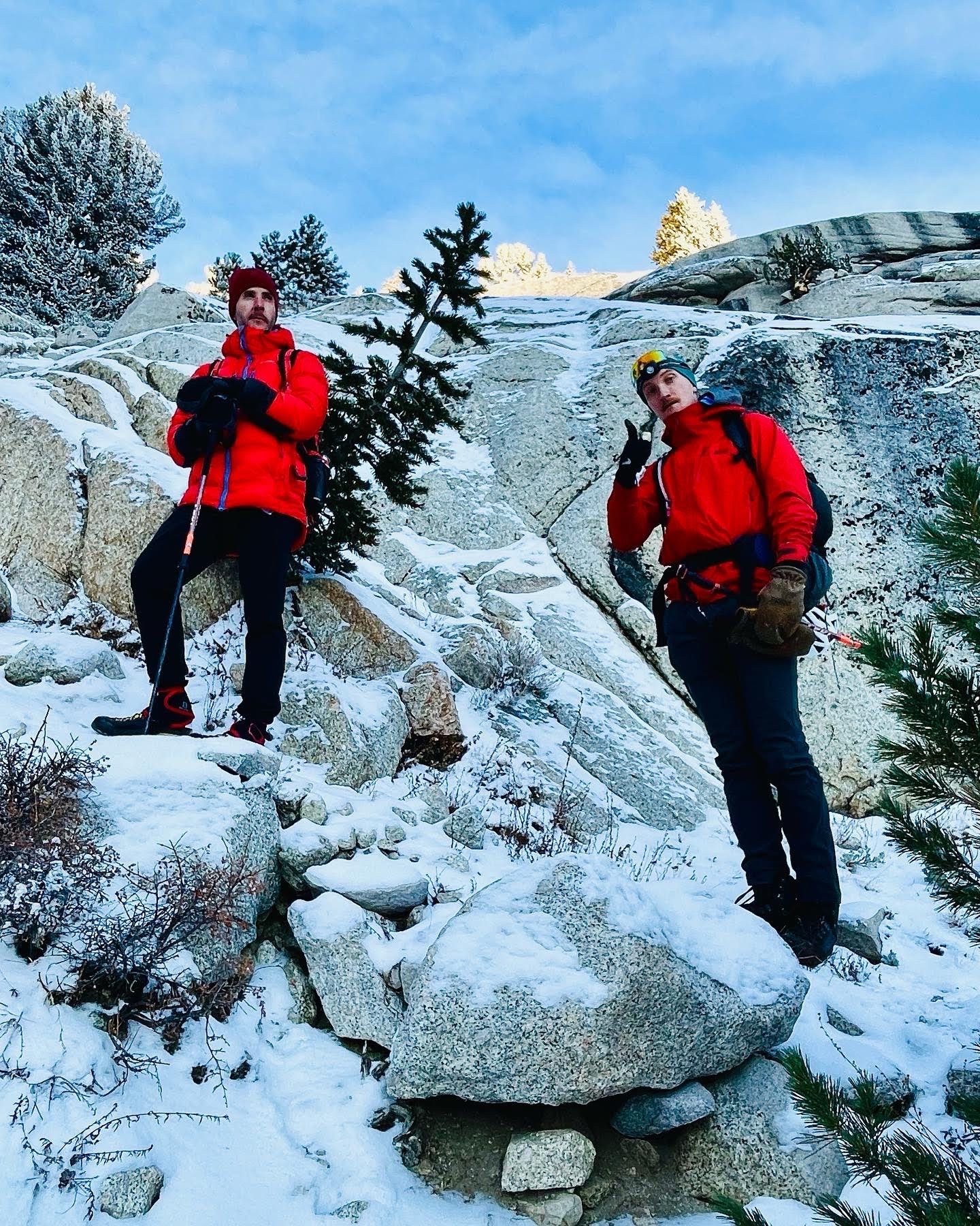
Friends who Joined me for this AdventureMy friend Ben Cady joined me on this winter ascent of Mount Whitney Mountaineer’s Route. Crazy enough, we had just met at the climbing gym here in Sacramento the week prior. Ben was also looking to bag a winter summit and it seemed like our acquaintance was almost just meant to be!
Ben moved to Sacramento a few months ago from Michigan. We quickly found out that we have many things in common, especially our desire to climb the tallest peaks in the world! We also met Simon Mueller on the trail, an all-star German alpinist that we traveled with during our climb.
It wasn’t long before we found out that Simon was on a quest to conquer the seven summits which is a shared goal among the three of us, so we naturally got along. Simon told us he had climbed Mount Kilimanjaro in Africa (19,341’) and Mount Blanc in Europe (15,771’). This led us to believe he was a very experienced climber, so we decided to stick together.
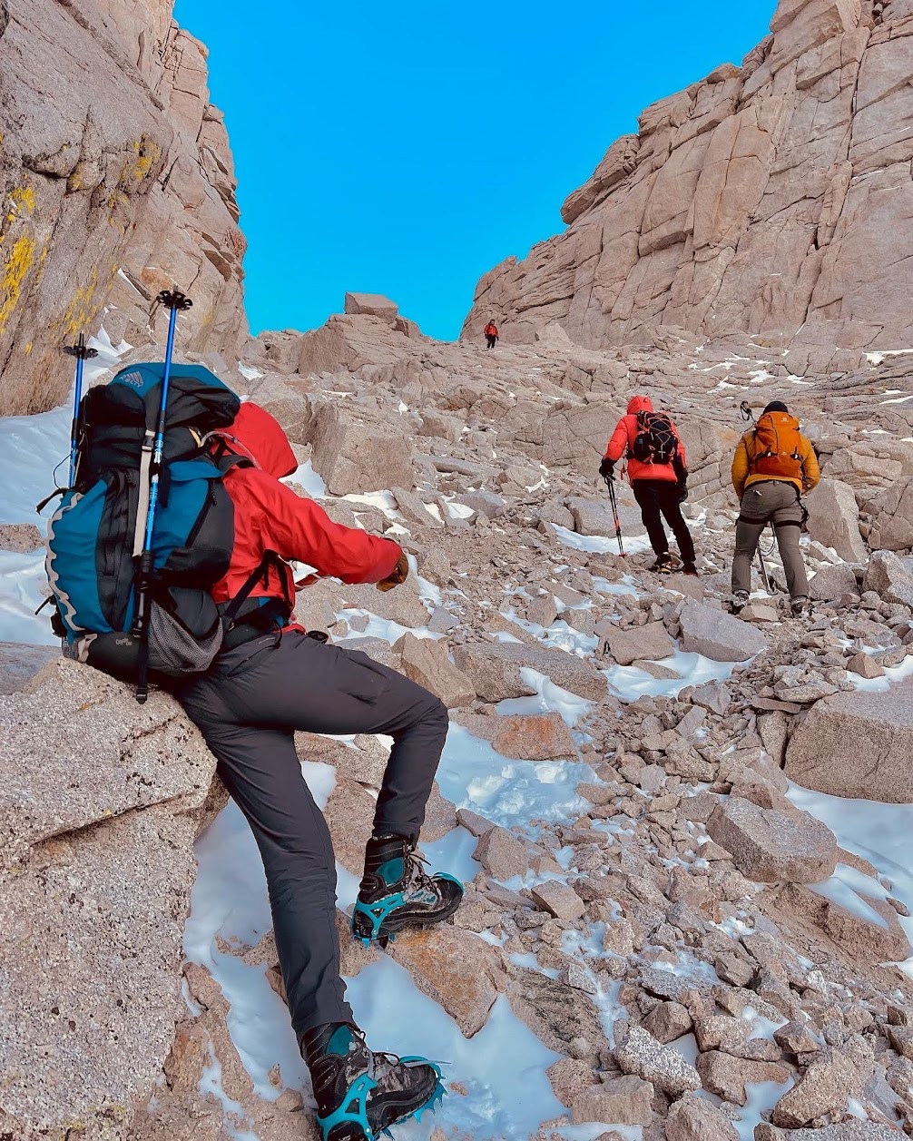
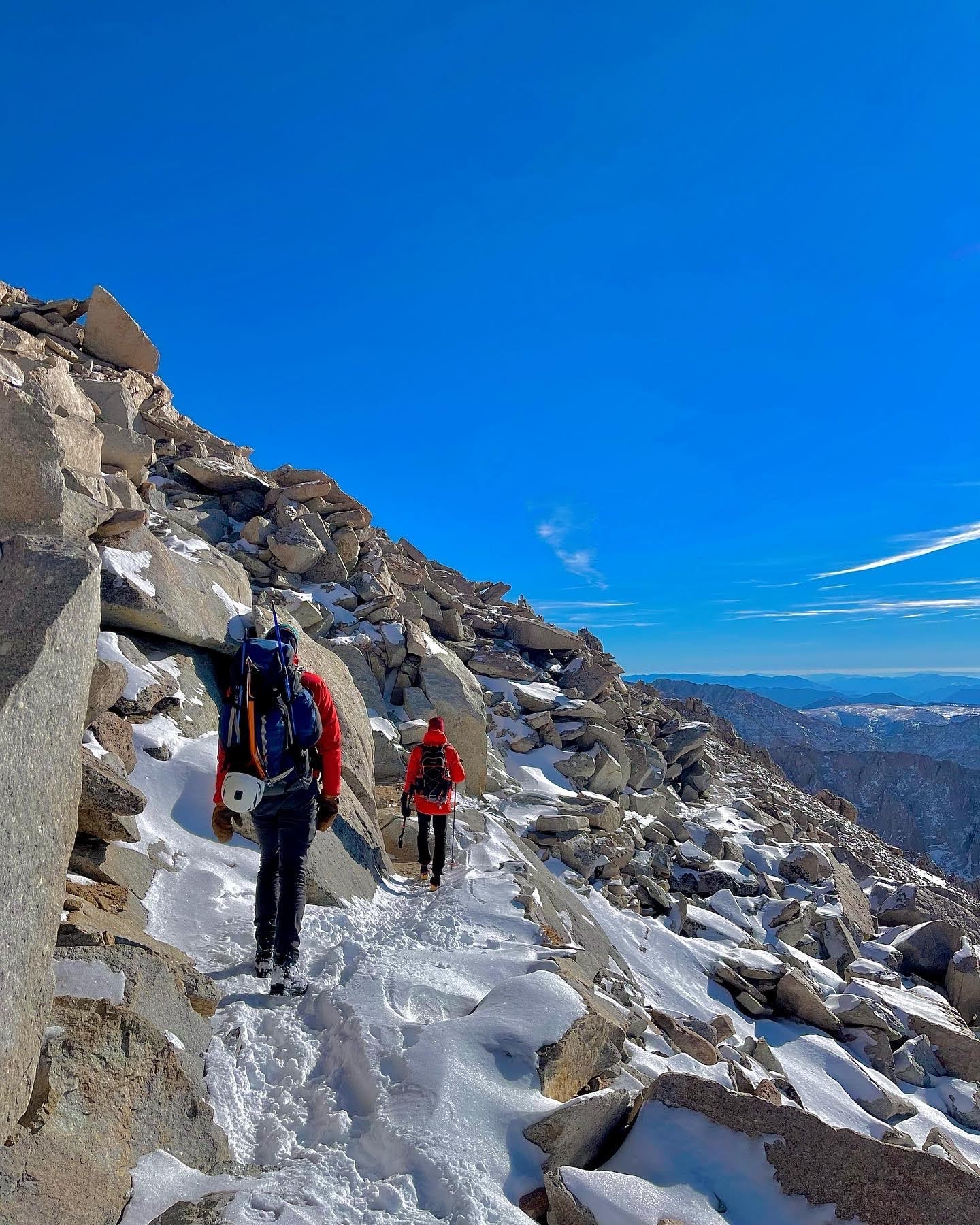
We did not have a mountaineering guide on this trek, but we did follow a map and generally knew which direction to head in since we had studied the route prior. However, the snow made the trail difficult to follow so route finding was required and is an important skill in this type of environment.
Mount Whitney Mountaineers Route © Sertan Usanmaz
Mount Whitney Mountaineers Route © Sertan Usanmaz
Mount Whitney Mountaineers Route © Sertan Usanmaz
Mount Whitney Mountaineers Route © Sertan Usanmaz
Mount Whitney Mountaineers Route © Sertan Usanmaz
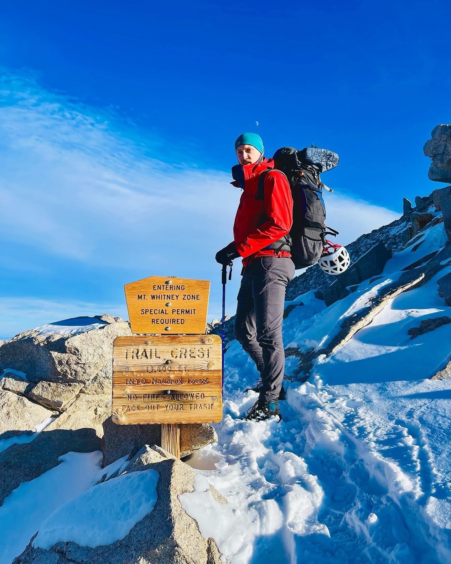
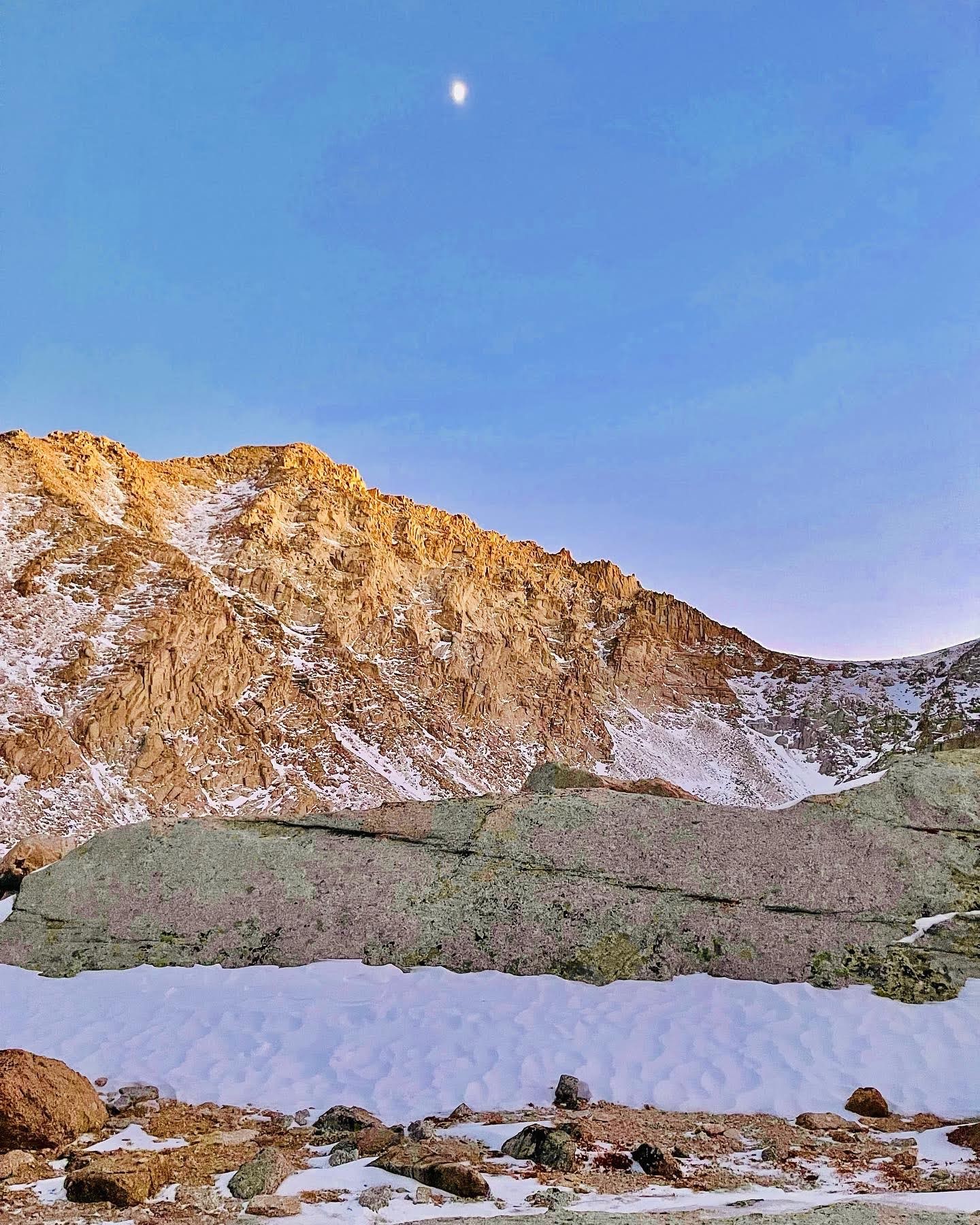
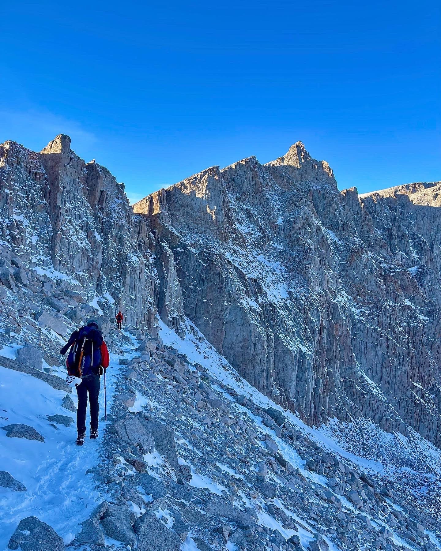
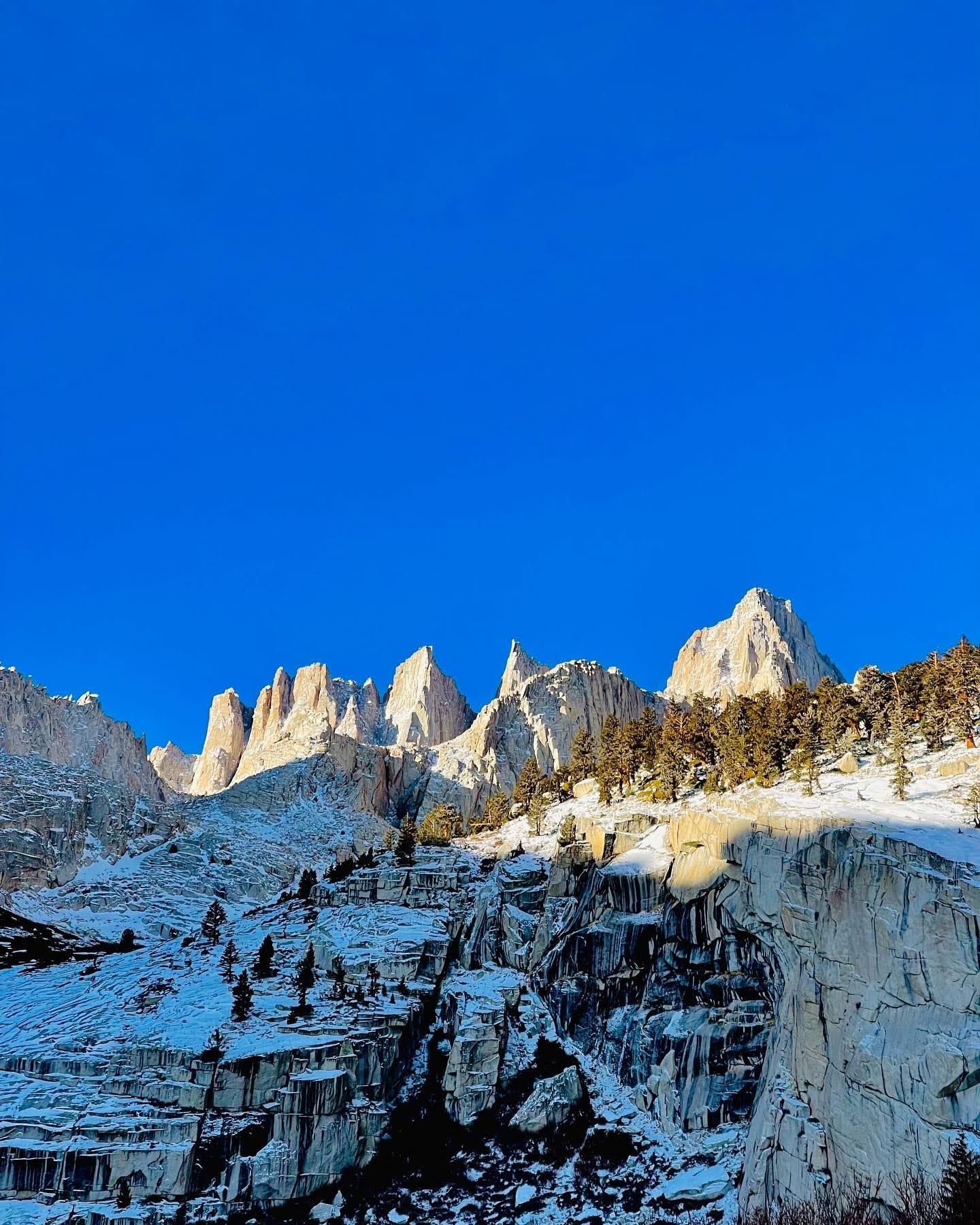
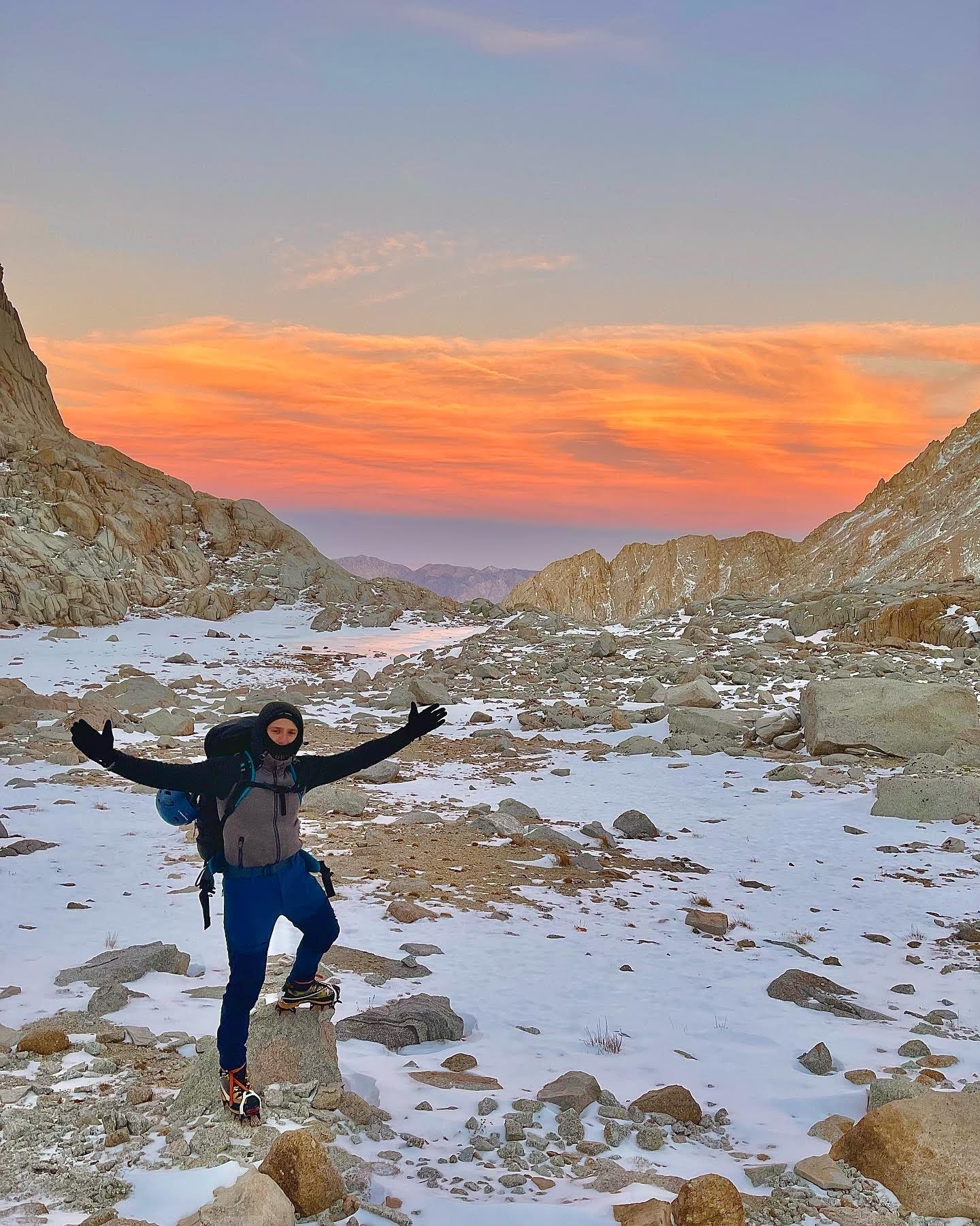
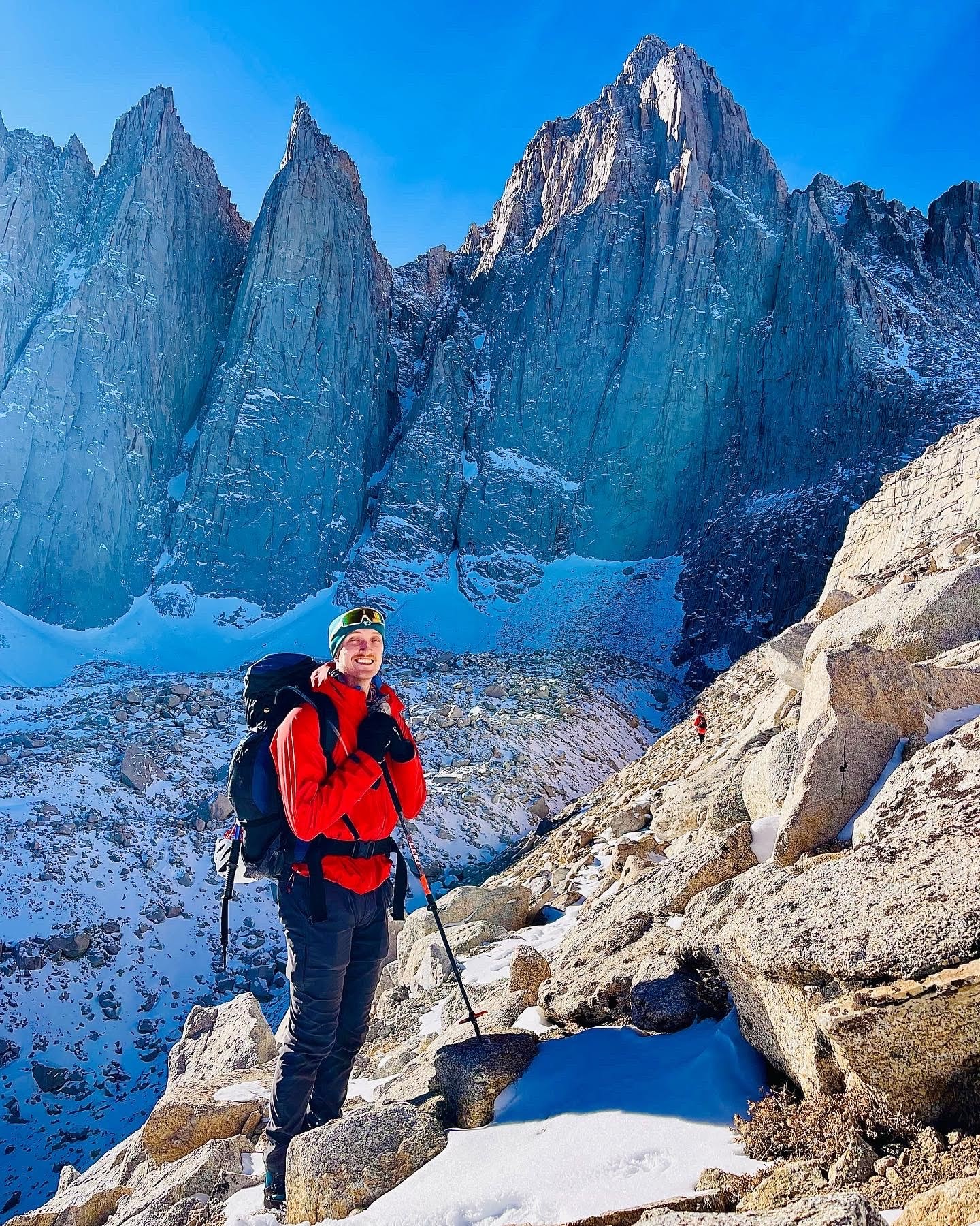
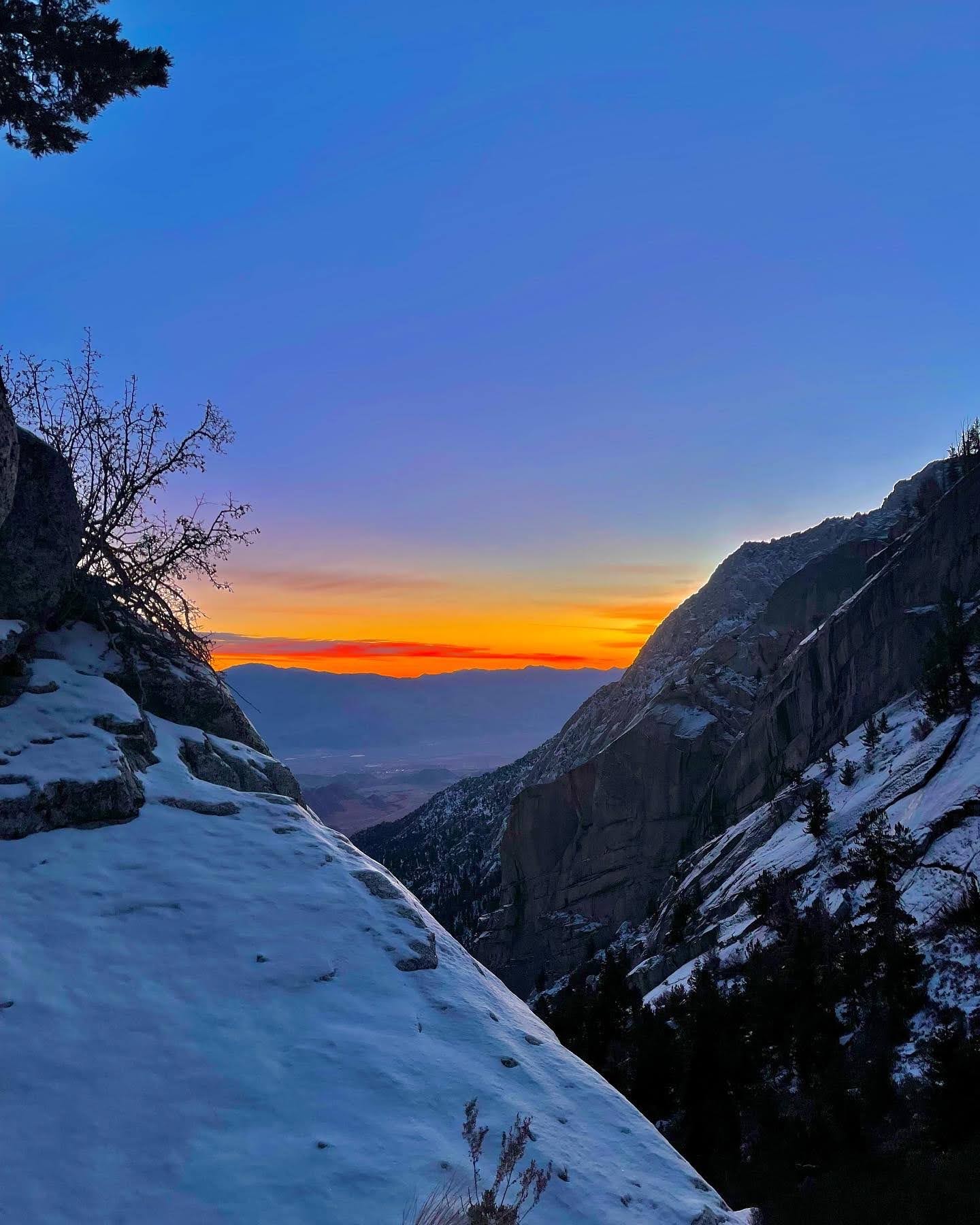
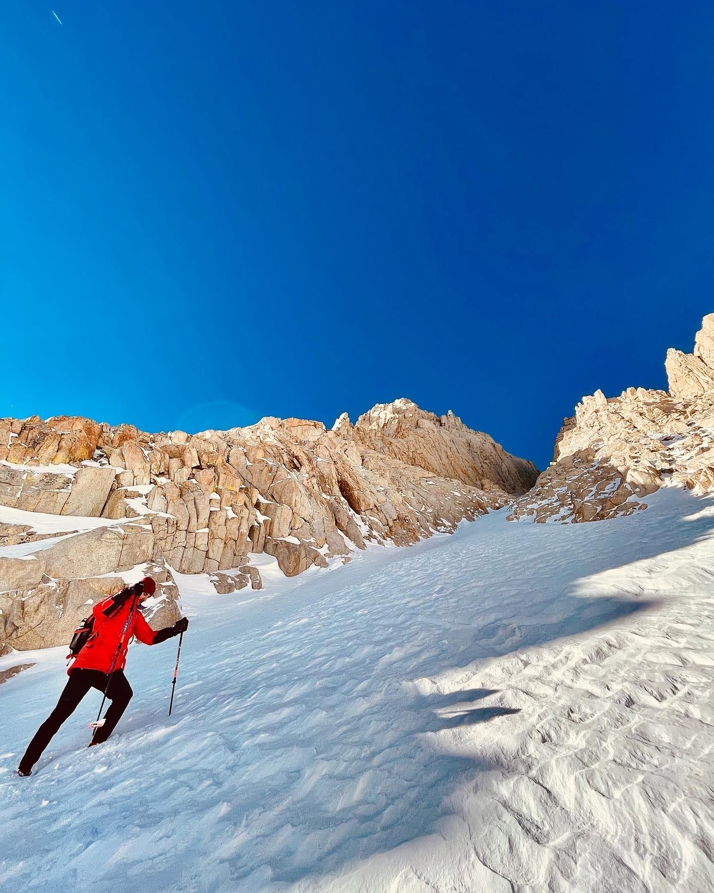
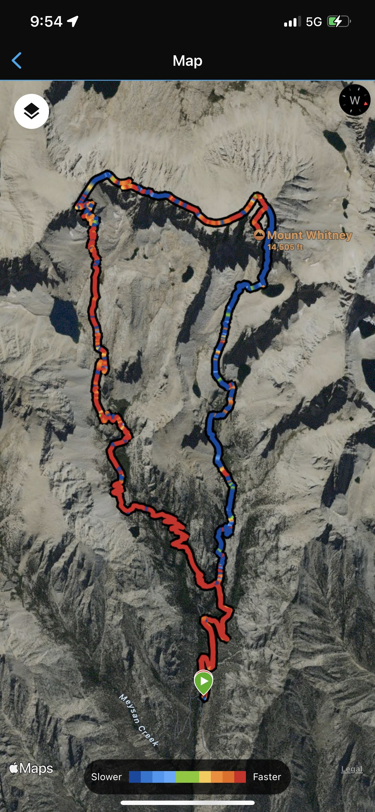
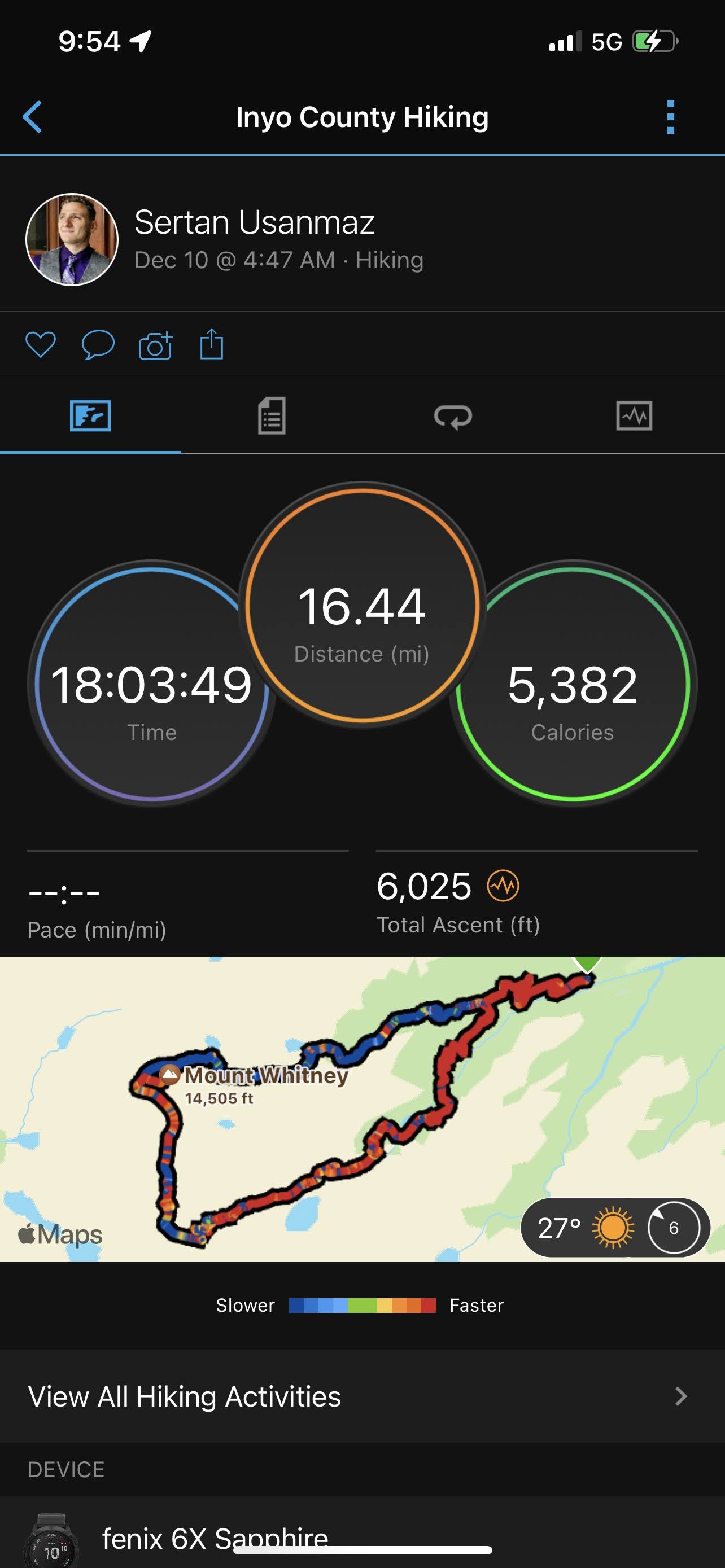
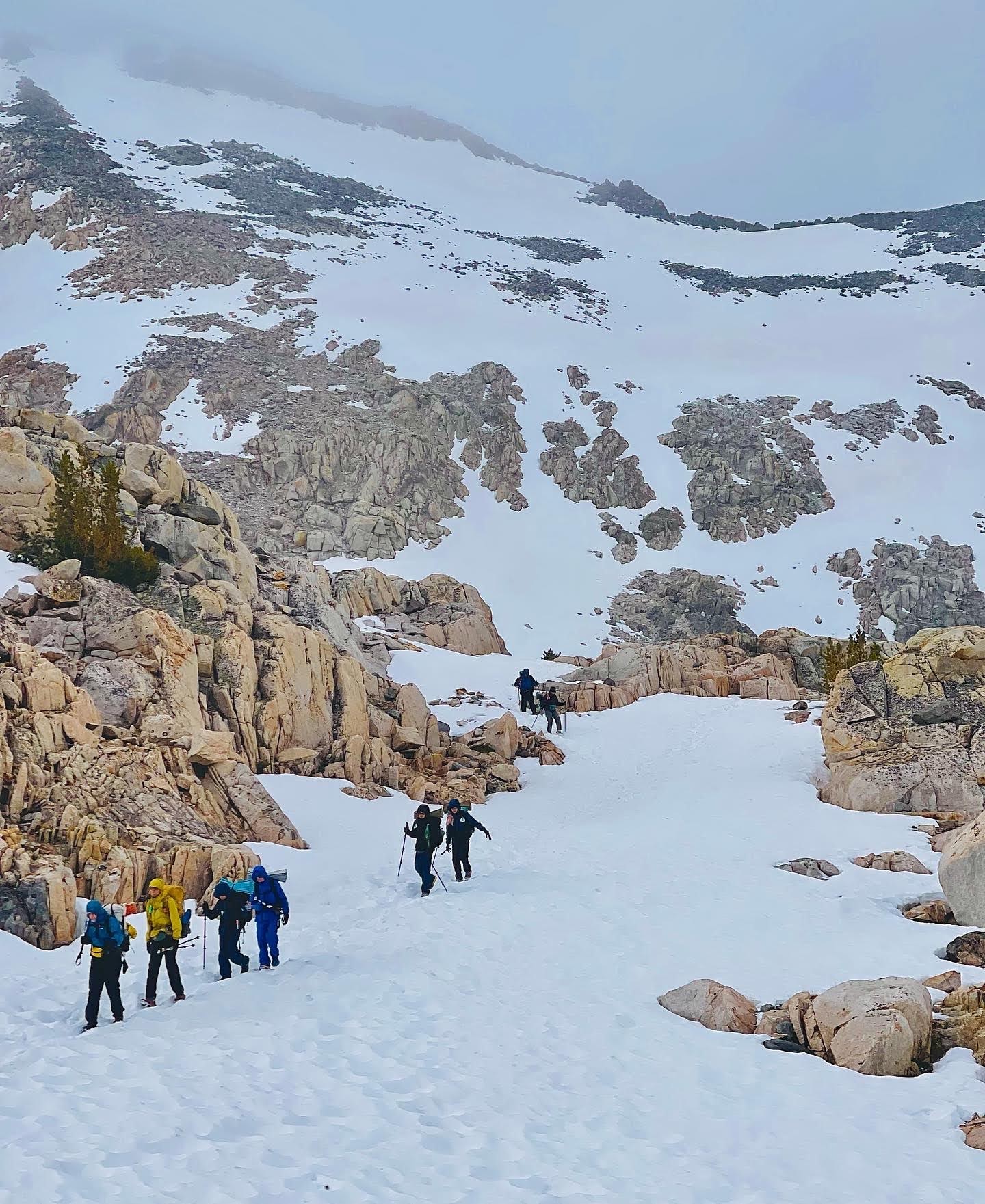
Overview of Mount Whitney Mountaineer’s RouteMount Whitney Mountaineer’s Route starts at Whitney Portal (same as the main Mount Whitney trail) but takes a different turn onto the North Fork Creek a little less than a mile in. This provides for a more direct approach in which you will gain significant elevation over a shorter distance, which will prove to be much more taxing on both your lungs and muscles.
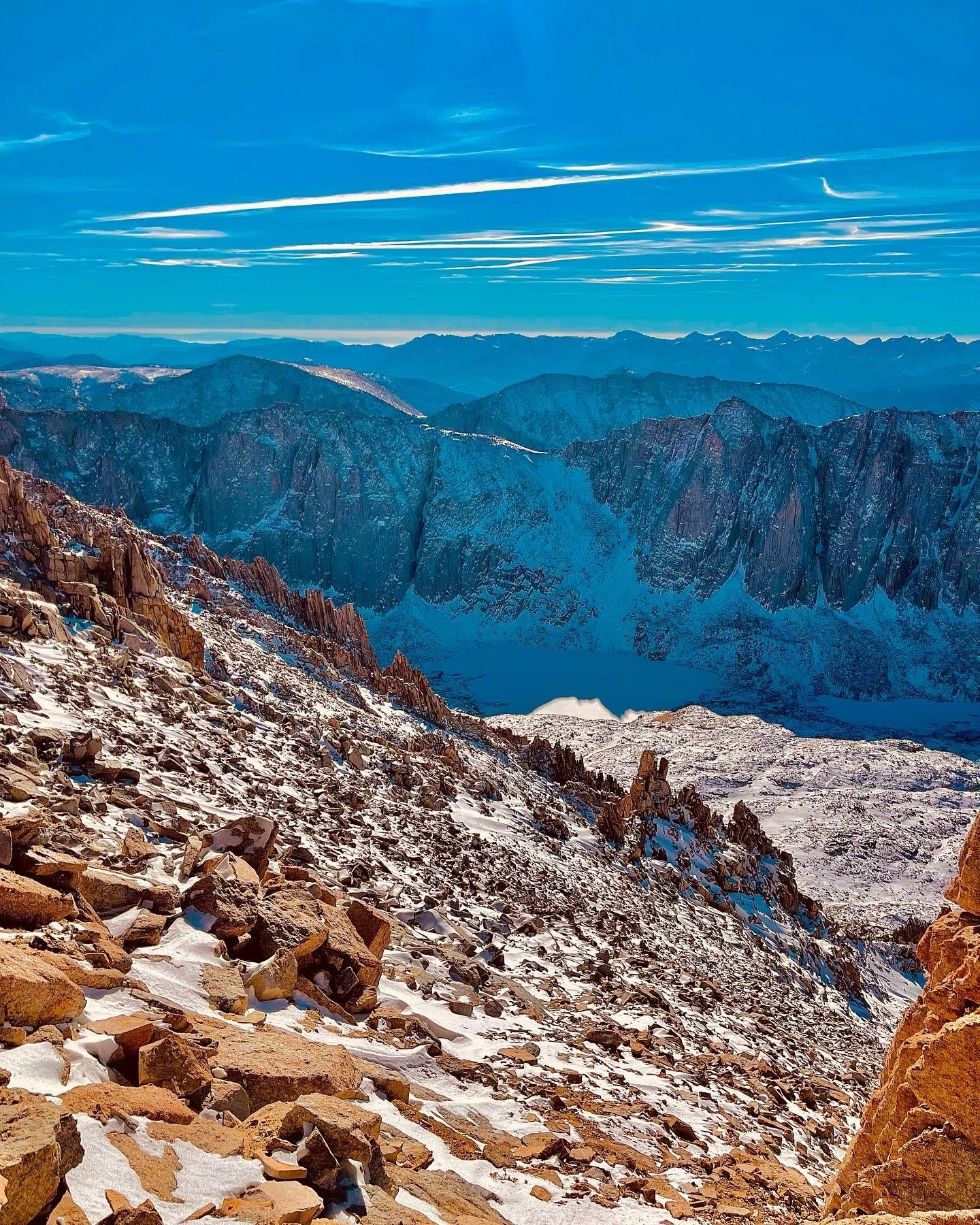
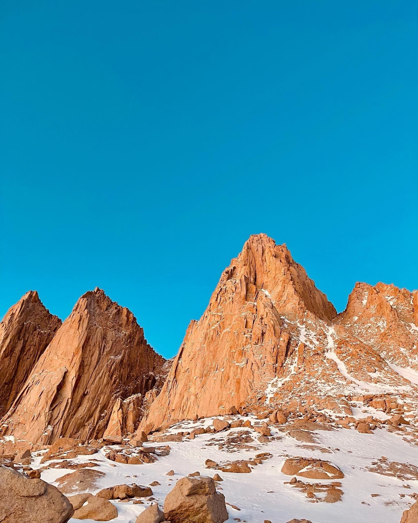
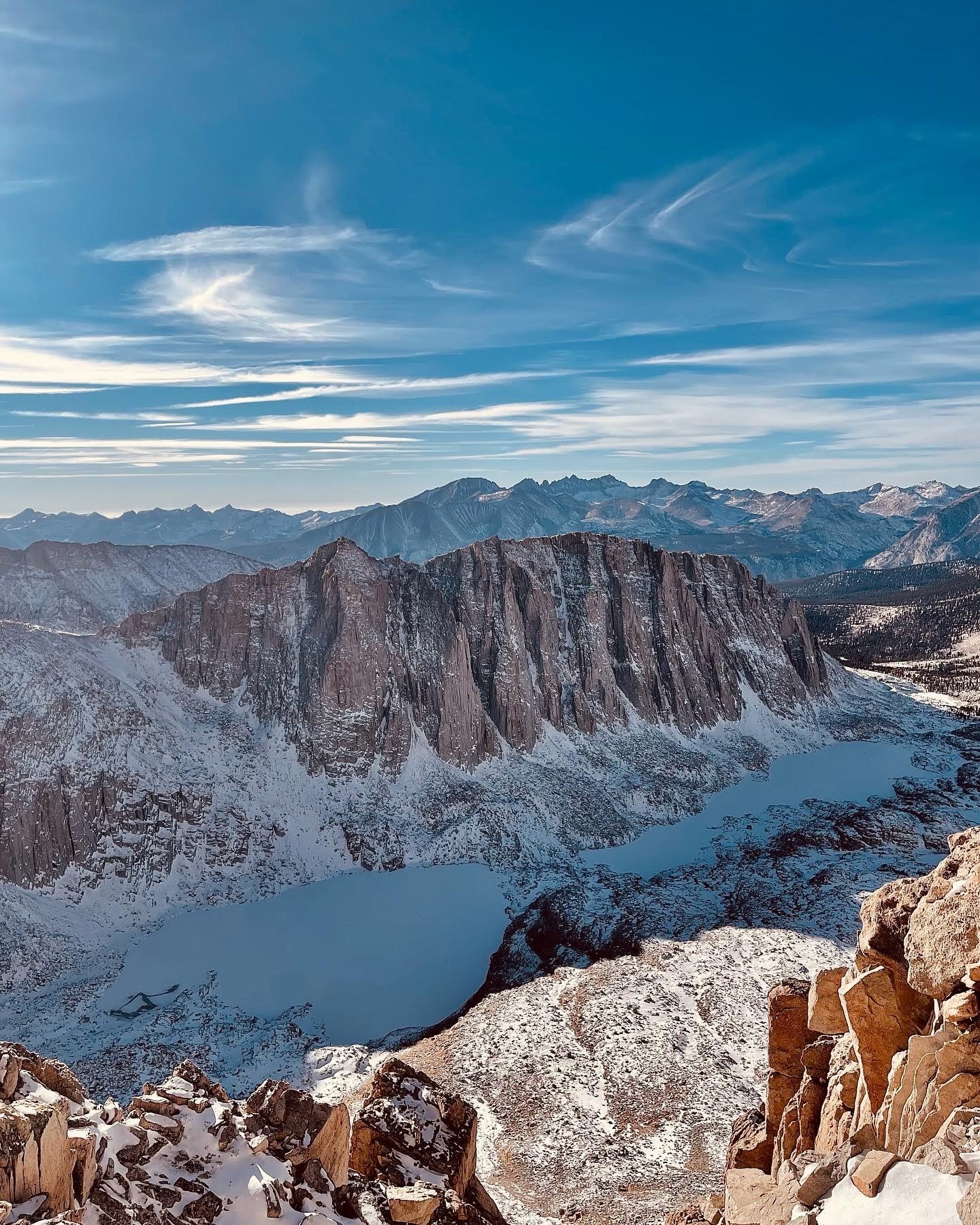
Once we reached the summit of Mount Whitney, we took the main trail back to Whitney Portal, which created one giant 16-mile loop (5 miles up and 11 miles back down). The scenery you get on the Mountaineer’s Route is some of the best that you will see in the Eastern Sierra. Everything from jagged mountain peaks to pristine alpine lakes, this trail is one of the prettiest I’ve ever seen and definitely gets a 10 out of 10 in my book.
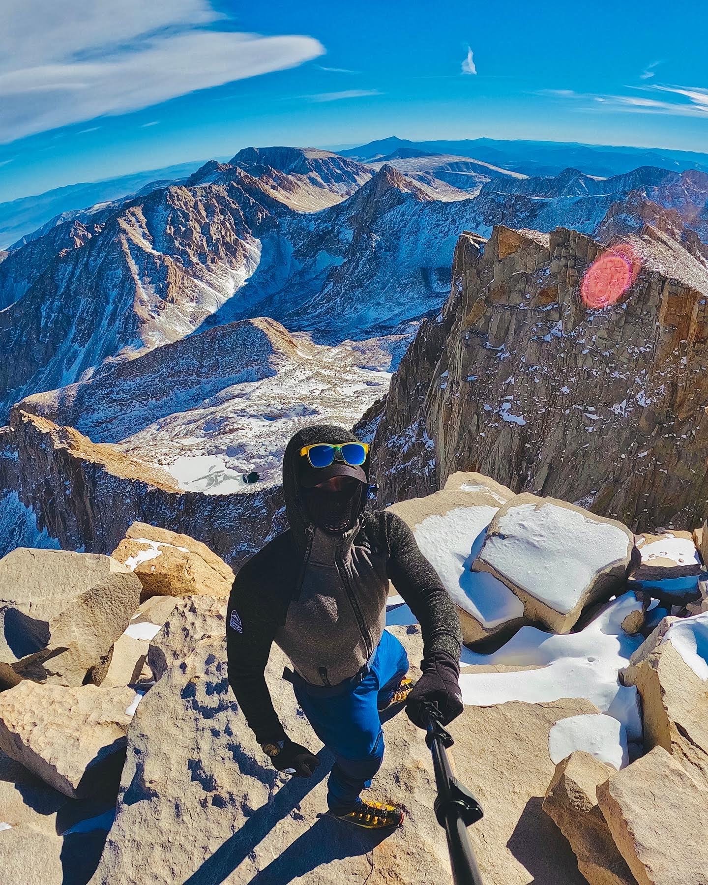
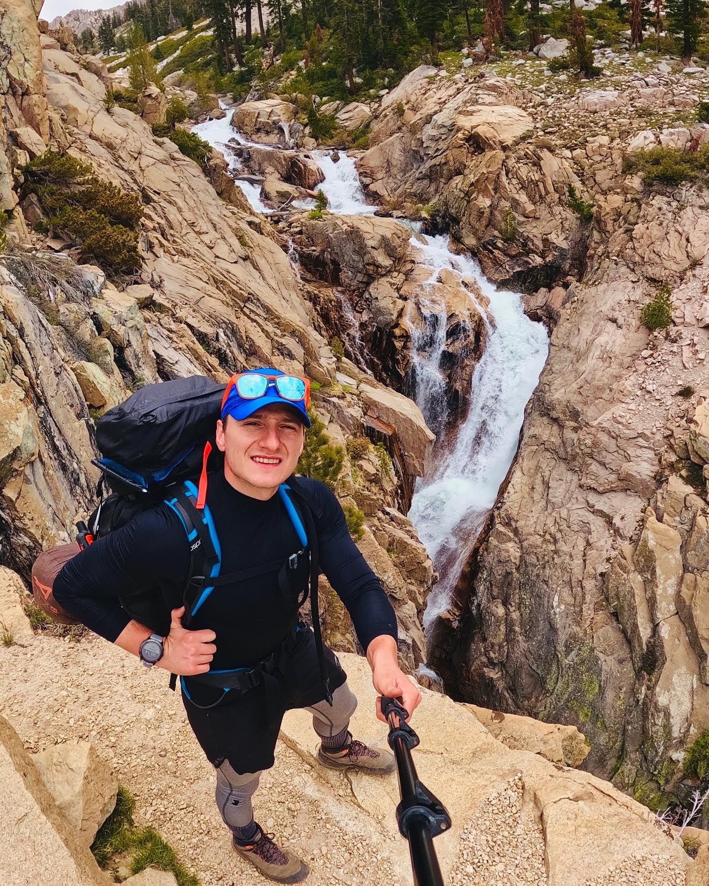
From the summit you can see panoramic views in all directions for miles on end. Nature really has its way of making you seem tiny in the grand scheme of things! The terrain was covered in snow for the most part. We also encountered times where we had to hop boulders and ice. There was also some bush whacking involved since we lost the trail under the snow quite a few times. I would definitely go back to experience this scenery again.
Mount Whitney Mountaineers Route © Sertan Usanmaz
Mount Whitney Mountaineers Route © Sertan Usanmaz
Mount Whitney Mountaineers Route © Sertan Usanmaz
Mount Whitney Mountaineers Route © Sertan Usanmaz
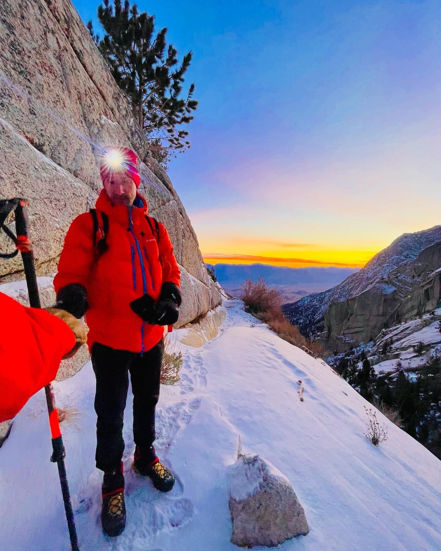
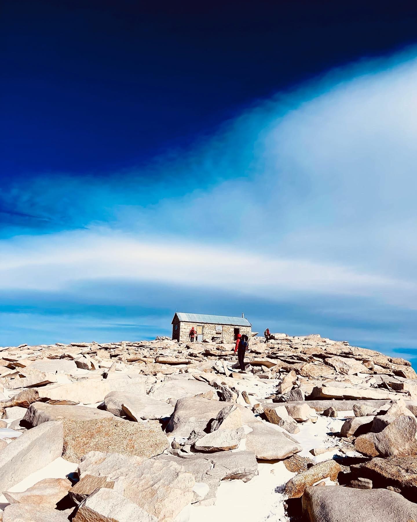
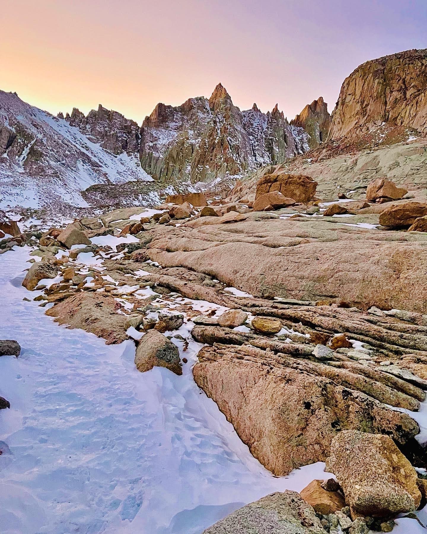
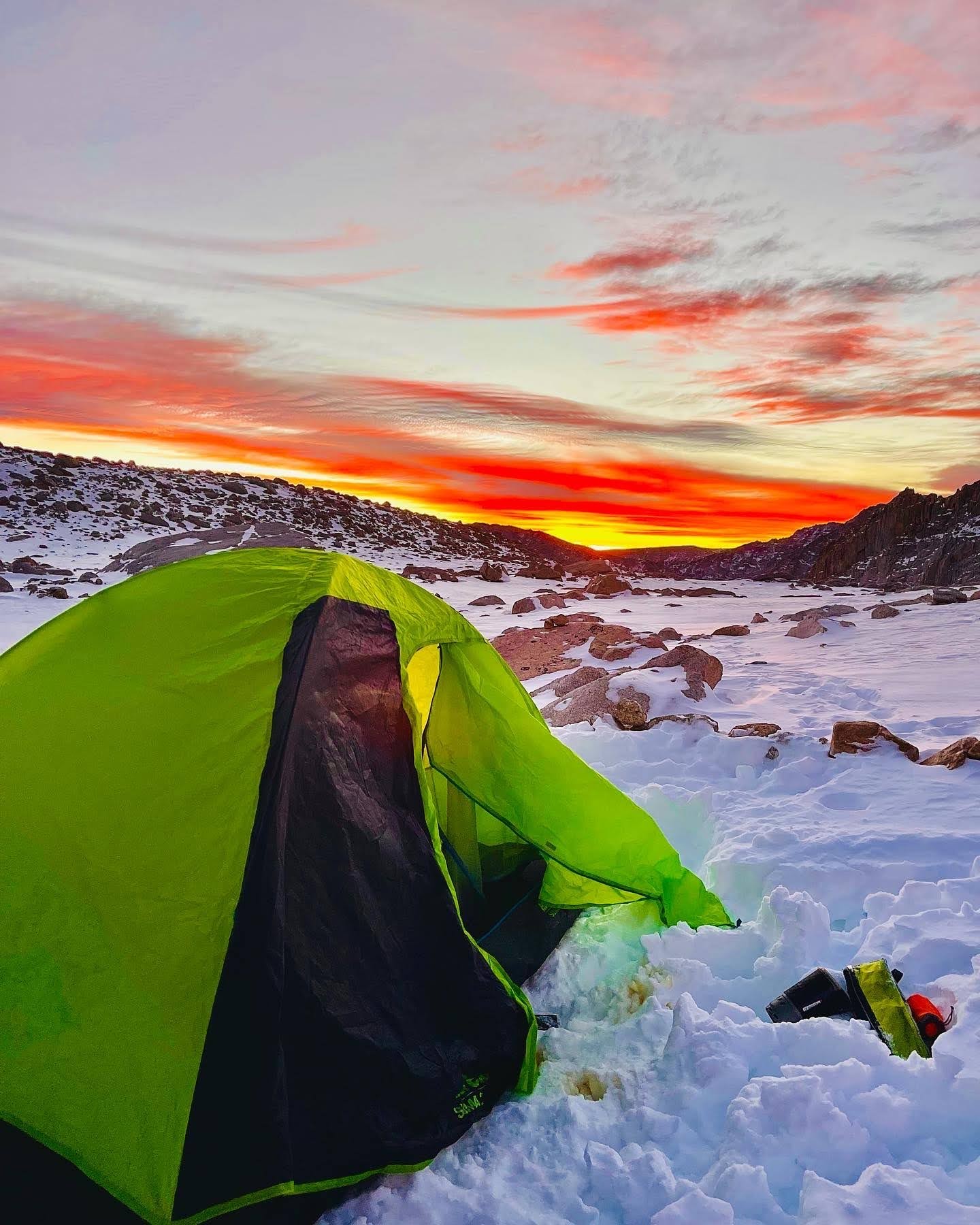
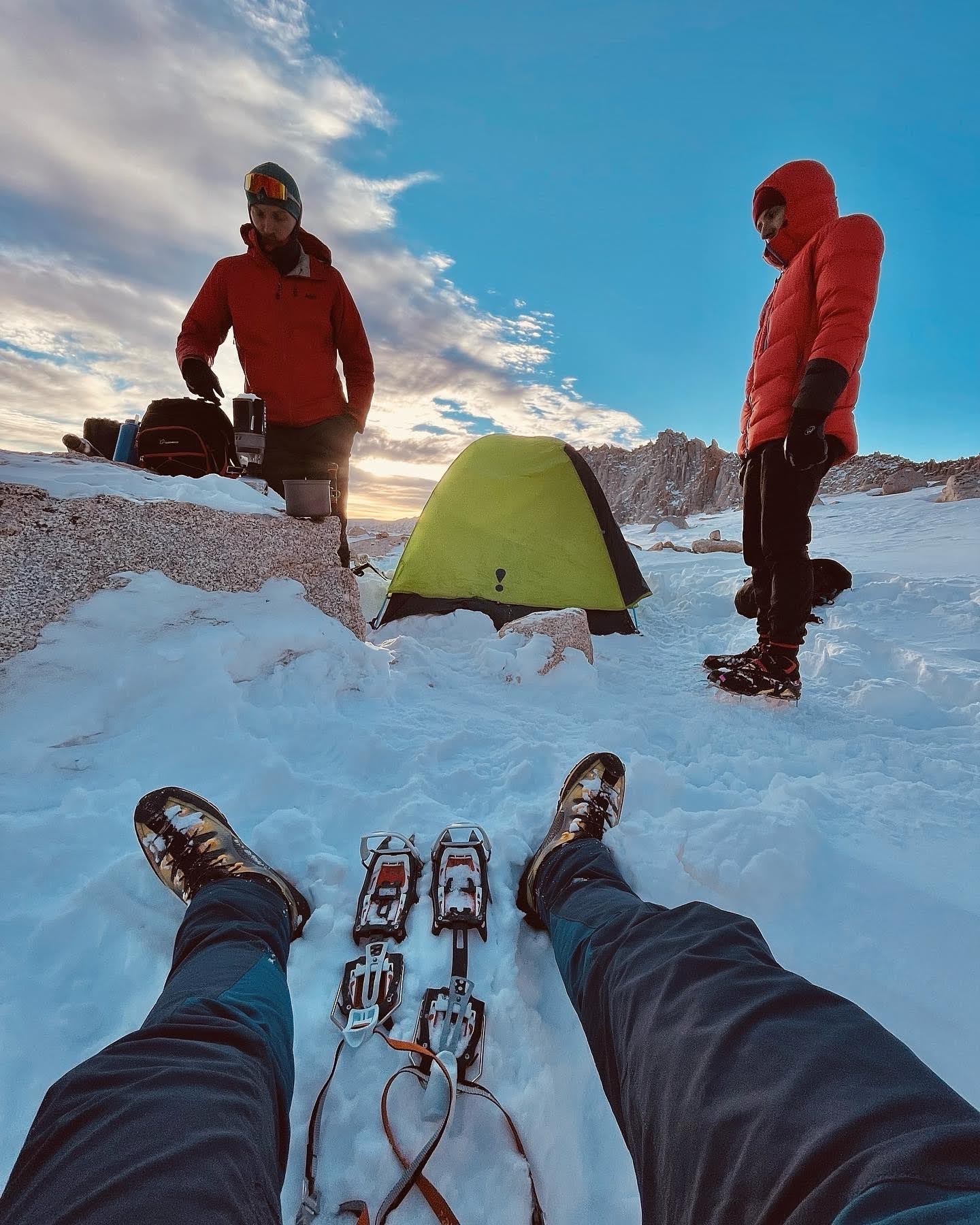
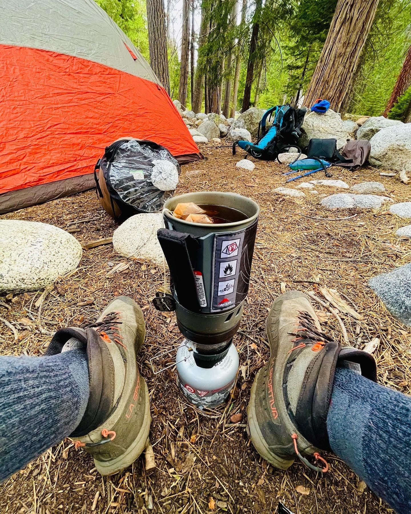
Duration of Mount Whitney Mountaineer’s RouteIt took us 2 days and 1 night to complete. On day 1 we began at 5am. Typically, it can be done in a day, but the snowy conditions slowed us down a bit – so we decided to camp one night at Iceberg Lake (12.500’) two-thirds the way up the mountain. The goal was to make it back off the mountain safely within the two-day weather window, so we had quite a bit of time.
We reached Iceberg Lake at 4pm and the summit the next day at noon, which gave us time to get back down off the mountain safely. We packed headlamps too, so coming back down in the dark was not an issue. We got down the mountain at 7pm on day 2 which was past our anticipated finish time of 6pm. My goal is to make it to the top of all mountains I climb but in a safe, meticulous and methodical way – I don’t give up without a fight!
Mount Whitney Mountaineers Route © Sertan Usanmaz

Mount Whitney Mountaineers Route © Sertan Usanmaz
Mount Whitney Mountaineers Route © Sertan Usanmaz
Mount Whitney Mountaineers Route © Sertan Usanmaz
Mount Whitney Mountaineers Route © Sertan Usanmaz
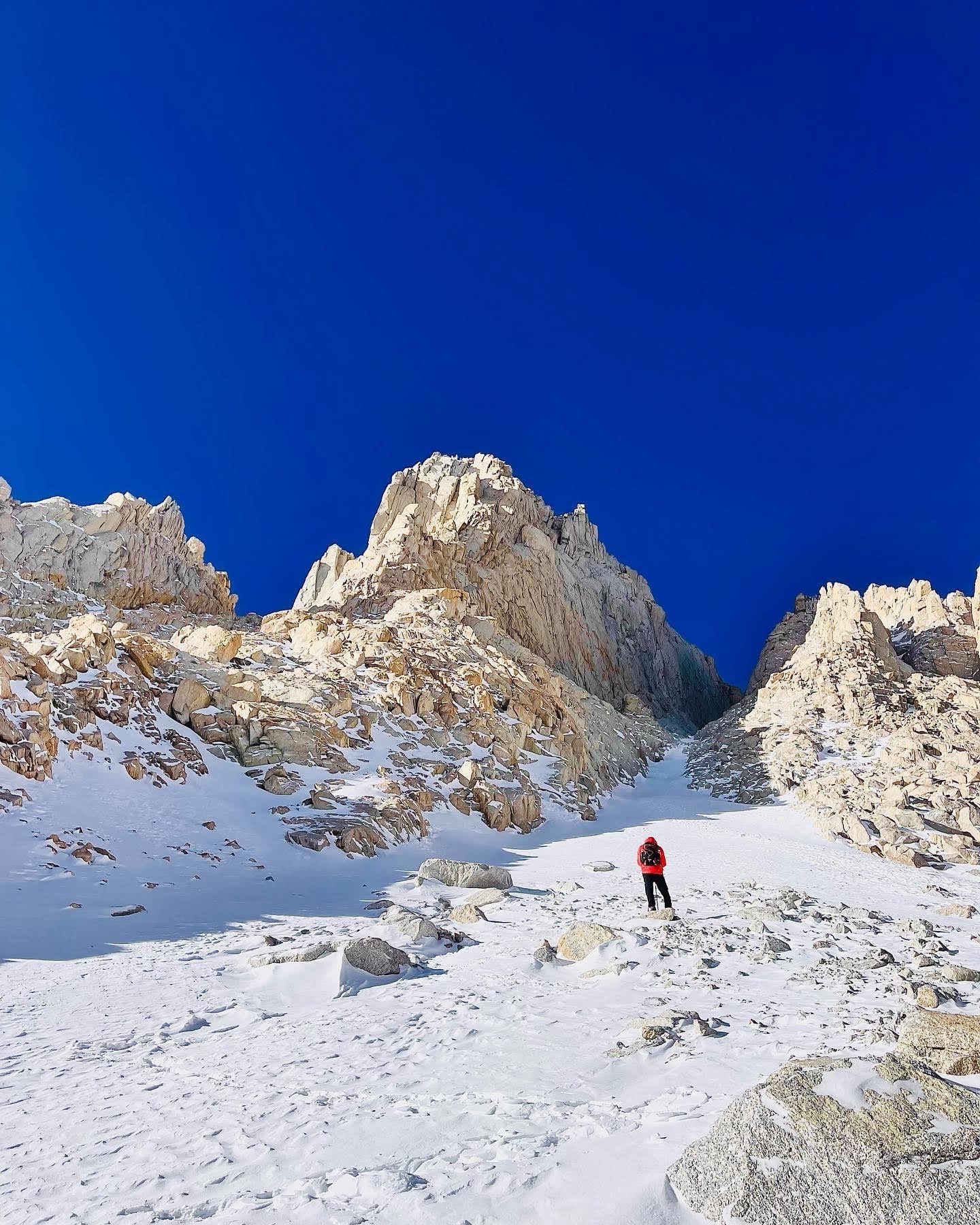
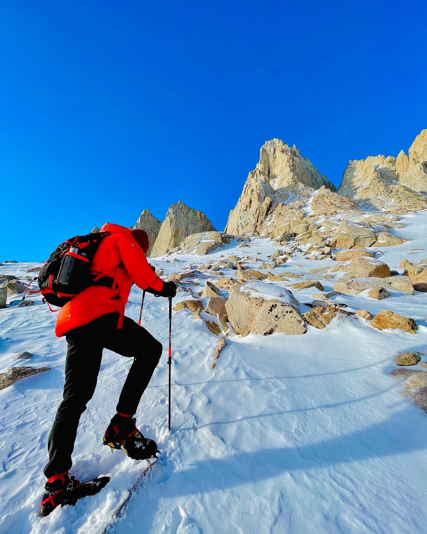
Most Challenging Aspect about this ClimbThe most changeling aspect of Mount Whitney Mountaineer’s Route was the steep elevation gain over a short distance on the way up (6,000 feet over 5 miles in the snow)! It was the mother of all stairmaster workouts!
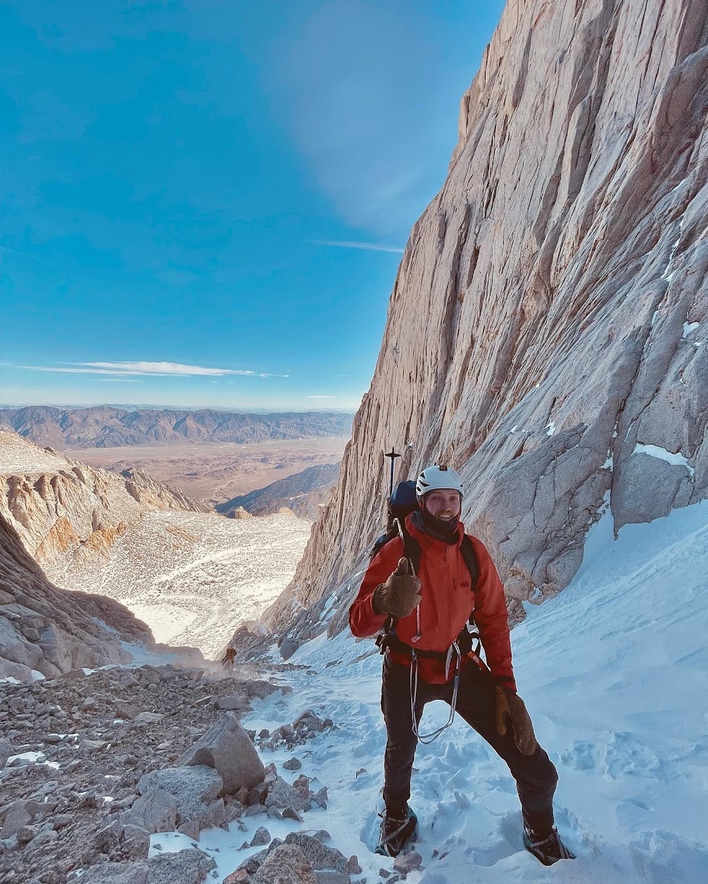
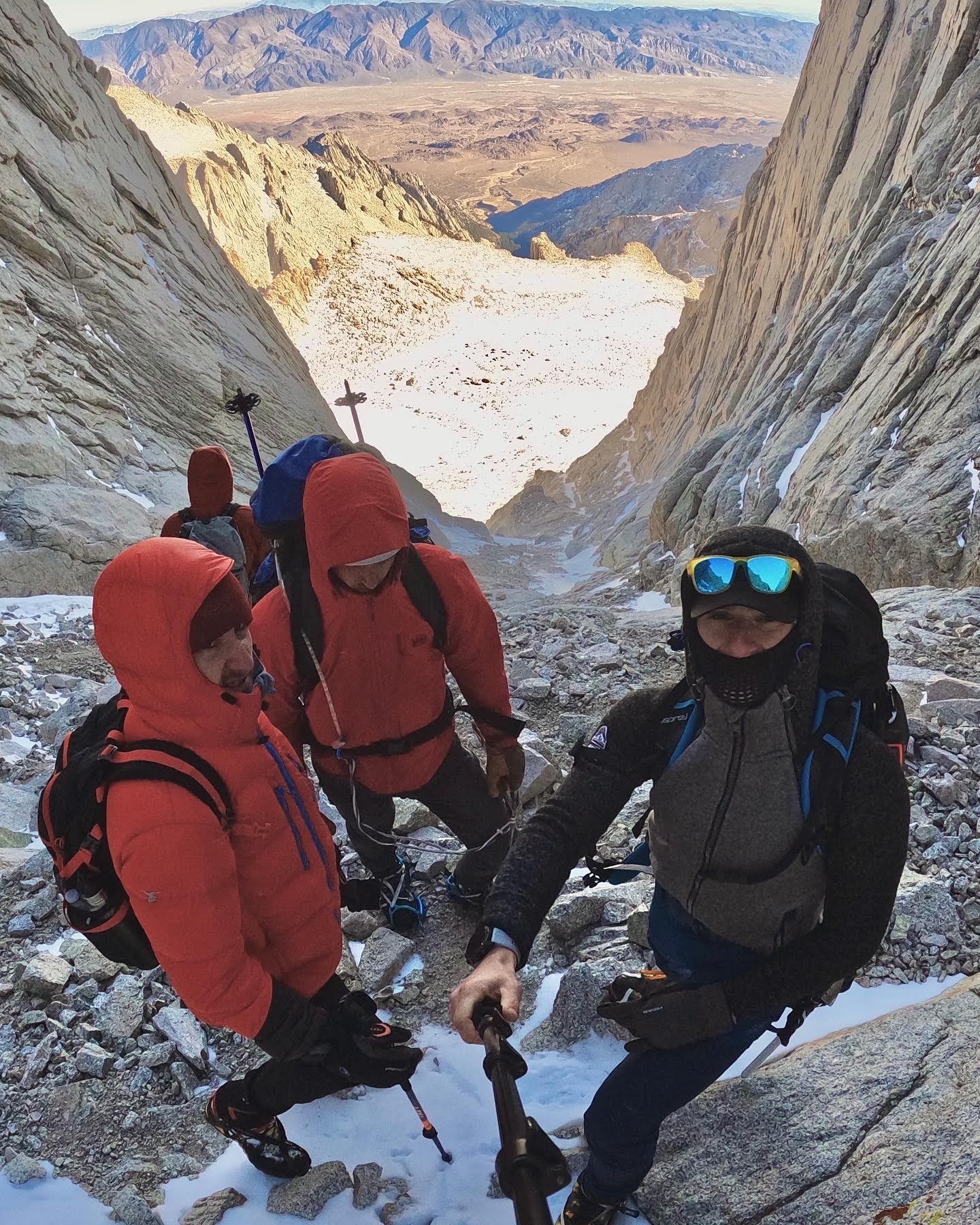
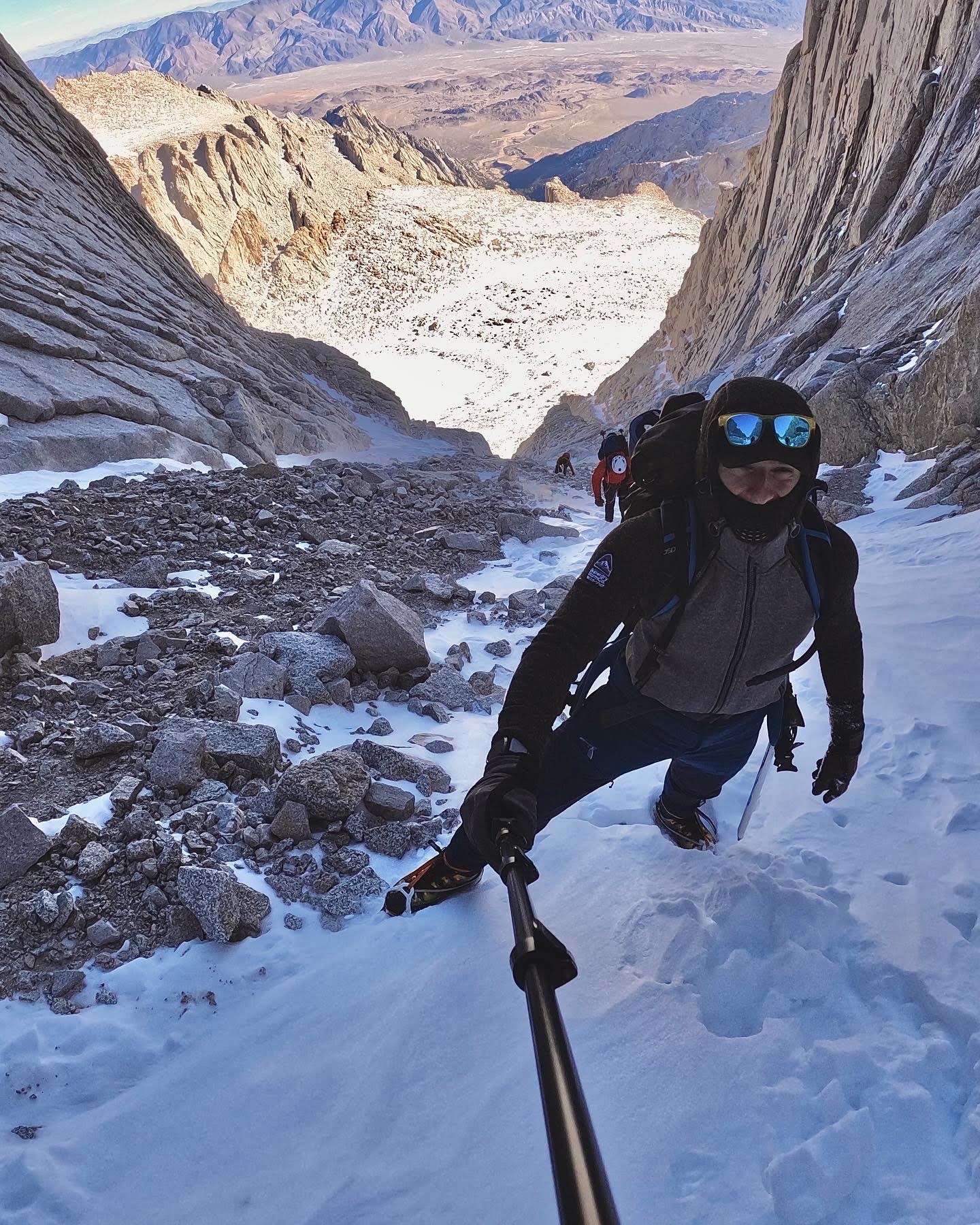
Acclimatizing was also another issue. I highly recommend you do this climb over two days and camp at Iceberg Lake to get used to the high elevation and avoid mountain sickness. Another challenging aspect of the climb was the steep grade (60-70%) on the last 2,000 feet summit stretch.
The couloir up the side of Whitney took courage to attempt but was doable with crampons to avoid slippage. We overcame the challenge by taking it one step at a time. I refer to this as flow state – the only thing that matters is the next step and your survival senses are heightened.
The best way to train for this is doing a lot of cardio and acclimatizing before your climb. We overcame this challenge by taking things one step at a time and utilizing ice equipment tools such as crampons and an ice axe.
Mount Whitney Mountaineers Route © Sertan Usanmaz

Mount Whitney Mountaineers Route © Sertan Usanmaz
Mount Whitney Mountaineers Route © Sertan Usanmaz
Mount Whitney Mountaineers Route © Sertan Usanmaz
Mount Whitney Mountaineers Route © Sertan Usanmaz
Mount Whitney Mountaineers Route © Sertan Usanmaz
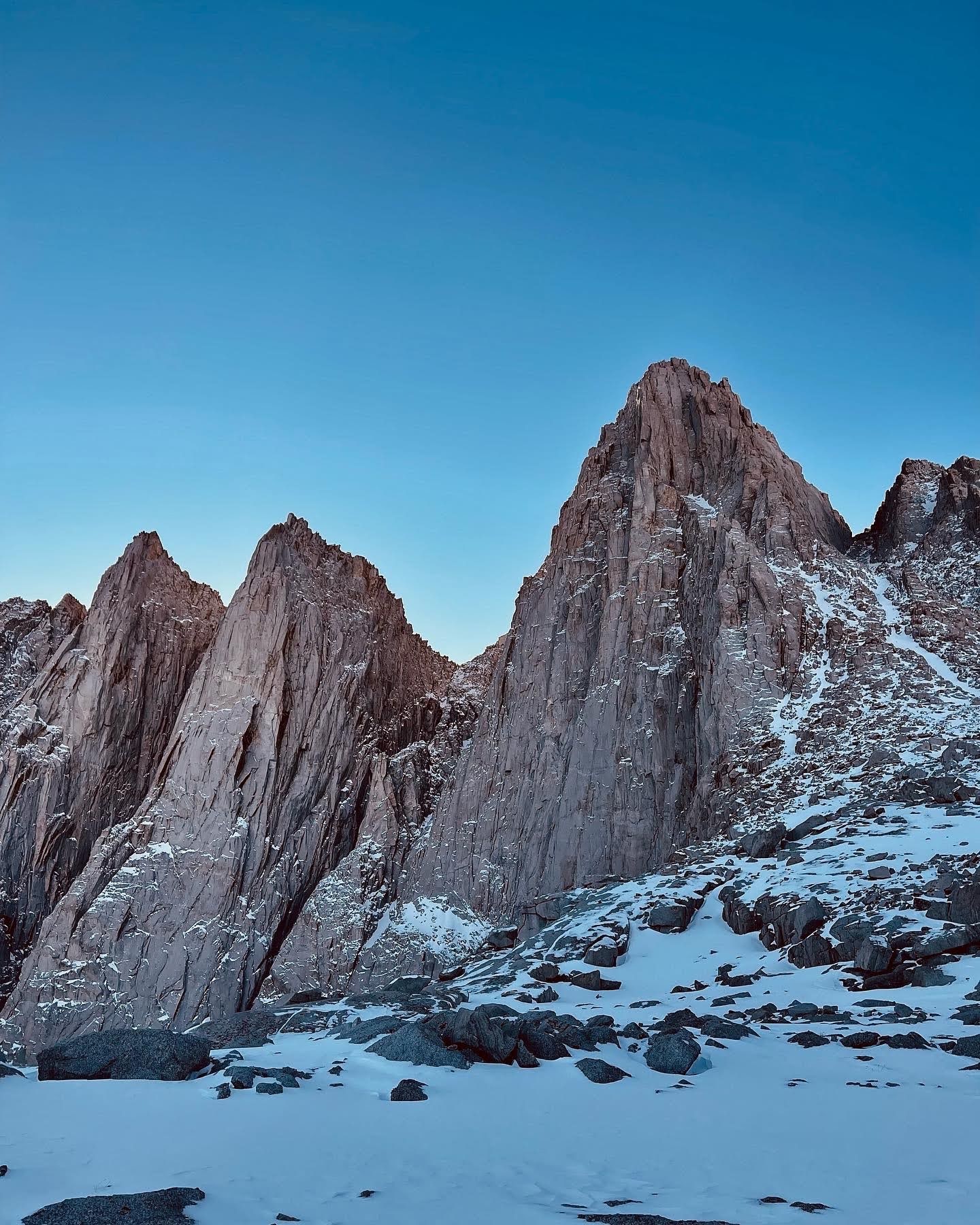
Number One Highlight of this ExperienceThe number one highlight of Mount Whitney’s Mountaineer’s Route is its direct approach. You get to see epic views from this approach because the summit is right in front of you the whole time! The traditional Mount Whitney trail doesn’t necessarily give you those same views.
The views from the top were surreal! We could see for miles in every direction and could point out a few other prominent fourteen thousand foot peaks – my second favorite, Mount Langley. You can also see the back side of Sequoia and Kings Canyon National Park! I am someone who loves a strenuous challenge, so this climb was exactly what I was looking for.
Mount Whitney Mountaineers Route © Sertan Usanmaz
Mount Whitney Mountaineers Route © Sertan Usanmaz
Mount Whitney Mountaineers Route © Sertan Usanmaz
Mount Whitney Mountaineers Route © Sertan Usanmaz
Mount Whitney Mountaineers Route © Sertan Usanmaz
Mount Whitney Mountaineers Route © Sertan Usanmaz
Mount Whitney Mountaineers Route © Sertan Usanmaz
Where to Stay near Mount WhitneyOn the way up Mount Whitney Mountaineer’s Route we camped at Iceberg Lake, which was just under the final summit push. Some other campsites include upper or lower Boy Scouts Lakes which are feasible options as well but at a lower elevation when compared to Iceberg Lake. I recommend camping at Iceberg Lake since it is right under the final summit push.
This will make day 2 of your climb easier. There is also a cheap hostel called Whitney Portal Hostel & Hotel in Lone Pine which is the town right before Whitney Portal if you are trying to get some rest before and after.
Need to Know Before you GoYou can also watch this hike on my Youtube Channel (please subscribe!) by clicking here.
Mount Whitney Mountaineers Route © Sertan Usanmaz
Mount Whitney Mountaineers Route © Sertan Usanmaz
Mount Whitney Mountaineers Route © Sertan Usanmaz
Mount Whitney Mountaineers Route © Sertan Usanmaz
Mount Whitney Mountaineers Route © Sertan Usanmaz
Mount Whitney Mountaineers Route © Sertan Usanmaz
TEST POSTS BELOW-----------
Sertan Usanmaz
Sertan is an avid outdoor enthusiast who loves summiting mountains, traveling, being in nature, and helping others find their passion for hiking!